Jacks Knob Trail
check with the trail manager for updated details before visiting.
Jacks Knob Trail
USDA Forest Service
- Length
4.5 miles
- Elevation Gain
--
- Route Type
out & back
- Length
4.5 miles - Elevation Gain
-- - Route Type
out & back
This blue-blazed trail begins with a short climb out of the Brasstown Bald parking lot, then descends nearly 1,500 feet through a series of switch backs that cover about two miles

The Brasstown parking lot is the official beginning of the Jacks Know Trail. Photo by Ed Boon.

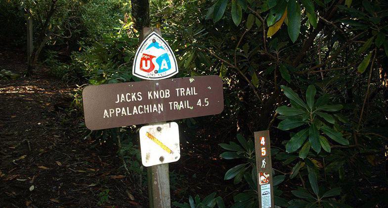
Trail sign near the Appalachian Trail at Jacks Knob. Photo by Michael Piasecki.
Location: Northeast Georgia, Brasstown Bald Visitor Center.
- States: Georgia
- Counties: Union
This blue-blazed trail begins with a short climb out of the Brasstown Bald parking lot, then descends nearly 1,500 feet through a series of switchbacks that cover about two miles. It crosses GA 180 in Jacks Gap and then climbs about 2.2 miles to the Appalachian Trail at Chattahoochee Gap. Approximately .2 mile south of Jacks Gap, the trail enters the Mark Trail Wilderness. Blazes will be farther apart on the wilderness portion of the trail.
Accessibility Information
No text provided.
Allowed Uses:
Dogs, on leash Hiking/WalkingOther Activities
- Camping
- Wildlife viewing / observation
Public Contact
Frances MasonUS Forest Service
P.O. Box 9
GainesvilleBlairsville, GA 30514
[email protected] • (706) 745-6928
www.fs.fed.us/conf
Contact the trail manager for current maps and visiting details.
More Details
- Elevation (low): 3000
- Elevation (high): 4350
- Elevation (cumulative): --
- Part of a Trail System? No
- Surface (primary): Soil
- Surfaces (additional): Soil
- Tread Width (average): 18"
- Tread Width (minimum): --
- Running length (minimum): --
- Tread Grade (average, percent): 8
- Tread Grade (maximum): 20
- Running length (maximum): --
- Cross-slope (average, percent): --
- Cross-slope (maximum): --
- Running length (maximum): --
- Certified as an NRT
May 5, 1980

