James F. Hall Trail
check with the trail manager for updated details before visiting.
James F. Hall Trail
City, Town, or County
Frontcountry Trail
Rail Trail
Urban Trail
- Length
1.7 miles
- Elevation Gain
--
- Route Type
out & back
- Length
1.7 miles - Elevation Gain
-- - Route Type
out & back
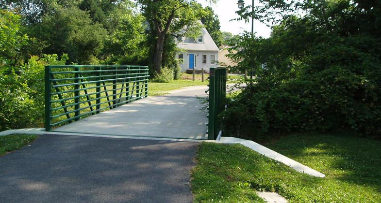
The James F. Hall Trail is a popular 1.7-mile cross-town pedestrian and bicycle trail in downtown Newark, Delaware.

JFH at Lewis Park Bridge. Photo by Charlie Emerson.

JFH at Chapel Street. Photo by Charlie Emerson.

JFH at Bradford Lane. Photo by Charlie Emerson.
Location: Newark, Delaware, In Newark south of the University alongside railroad tracks, Library Street west to Phillips Park.
- States: Delaware
- Counties: New Castle
The 8' wide hard surface pathway is equipped with Emergency Call Boxes linked directly to the Newark Police Department Dispatch Center. The trail passes through three City parks which feature several active recreation facilities, a pristine wetland area, footbridge crossings of two streams, and passes by the Old Newark Train Station which is home to the Newark Historic Society.
It is also directly accessible to residential neighborhoods, University of Delaware student housing units and child care facilities, the Delaware Technology Park, and a shopping center.
Several local services, non-profit organizations, and university student groups utilize all or parts of the trail for run/walk fundraising events. The City of Newark partnered with the University of Delaware, Delaware's Department of Transportation, and the Department of Natural Resources and Environmental Control to make the project happen.
A second connecting trail is in the final planning stages now. Construction will likely begin in the spring of 2010. This new trail will connect to the Hall Trail and proceed north, through Newark's downtown district, and continue on to empty into the White Clay Creek State Park and its trail system.
Accessibility Information
No text provided.
Allowed Uses:
Bicycling Dogs, on leash Hiking/WalkingOther Activities
- Wildlife viewing / observation
Public Contact
Newark Parks and Recreation220 Elkton Road
Newark, DE 19711
(302) 366-7060
www.cityofnewarkde.u
Contact the trail manager for current maps and visiting details.
More Details
- Elevation (low): 120
- Elevation (high): 125
- Elevation (cumulative): --
- Part of a Trail System? No
- Surface (primary): Paved
- Surfaces (additional): Paved, Boardwalk
- Tread Width (average): 96"
- Tread Width (minimum): --
- Running length (minimum): --
- Tread Grade (average, percent): --
- Tread Grade (maximum): 6
- Running length (maximum): --
- Cross-slope (average, percent): --
- Cross-slope (maximum): --
- Running length (maximum): --
- Certified as an NRT
May 2, 2010

