Jedediah Smith
check with the trail manager for updated details before visiting.
Jedediah Smith
City, Town, or County
Frontcountry Trail
Urban Trail
- Length
26 miles
- Elevation Gain
--
- Route Type
out & back
- Length
26 miles - Elevation Gain
-- - Route Type
out & back
The Jedediah Smith Memorial Trail is the primary recreational trail which runs along the entire length of the American River Parkway. It connects Discovery Park to Folsom Lake and provides an important bicycle commuter route. Although the trail is designated for bicycle and in-line skating use, it is also heavily used by hikers and runners. Additional bicycle trail segments have been constructed to provide supplemental trail connections and access points.

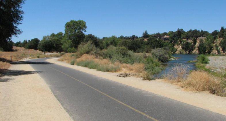
American River Bike Trail, just east of the Bridge St entrance, at approximately Mile 21. Photo by Cravenmonket/wiki.
Location: E Along American River Greenway from Sacramento to Folsom.
- States: California
- Counties: Sacramento
- Cities/Townships: Folsom, Rancho Cordova, Sacramento
The Jedediah Smith Memorial Trail (or American River Bike Trail) is a paved multi-use pathway that runs between the confluence of the Sacramento River with the American River, just north of downtown Sacramento, CA, and Beal's Point at Folsom Lake, north of Folsom, CA. The trail is 32 miles (51 km) long and is used as a major recreational destination, as well as a commuter artery for cyclists. The trail is considered one of the longest paved purpose-built bike trails in the country. Activities along the trail include hiking, horseback riding, cycling, inline skating, jogging, and strolling. It is also a very popular, healthy, environmentally sound alternative for commuting to work. Visitors often combine their trail activities with shopping or eating, while others enjoy fishing or picnicking beneath a shady tree. Equestrian access to the paved trail surface is allowed only at trail crossings and bridges.
Accessibility Information
No text provided.
Allowed Uses:
Bicycling Boating, motorized Boating, human-powered Dogs, on leash Equestrian Hiking/WalkingOther Activities
- Fishing
- Heritage and history
- Wildlife viewing / observation
Public Contact
Sacramento County Regional Parks10361 Rockingham Drive, Suite 100
Sacramento, CA 95827
[email protected] • (916) 875-6961
www.sacparks.net/Pages/default.aspx
Contact the trail manager for current maps and visiting details.
More Details
- Elevation (low): --
- Elevation (high): --
- Elevation (cumulative): --
- Part of a Trail System? No
- Surface (primary): Paved
- Surfaces (additional): Rock, crushed, Soil
- Tread Width (average): 0"
- Tread Width (minimum): --
- Running length (minimum): --
- Tread Grade (average, percent): --
- Tread Grade (maximum):
- Running length (maximum): --
- Cross-slope (average, percent): --
- Cross-slope (maximum): --
- Running length (maximum): --
- Certified as an NRT
Mar 20, 1974

