Joe's Canyon
This information is a public record of the 1981 NRT application and may be out of date if it has not been updated by a trail manager --
check with the trail manager for updated details before visiting.
check with the trail manager for updated details before visiting.
Joe's Canyon
National Park Service
Backcountry Trail
- Length
3.1 miles
- Elevation Gain
--
- Route Type
out & back
- Length
3.1 miles - Elevation Gain
-- - Route Type
out & back
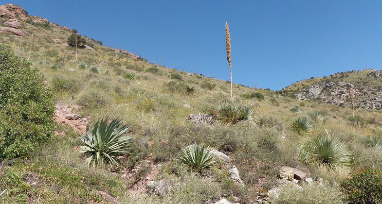
Enjoyable trail that climbs a sheltered ravine on the south side of Montezuma Canyon, then follows a treeless ridge towards Coronado Peak, giving excellent views all the way
Location: At Coronado Nat. Mon. near Hereford. Trail starts 500 ft. W of visitor center.
- States: Arizona
Elevation 5230-6575. The trail climbs about 1000 feet in the first mile with scenic views of Montezuma Canyon and the San Pedro River Valley. After reaching the saddle at the top of Smugglers Ridge the trail continues west with views of desert grasslands
Accessibility Information
No text provided.
Allowed Uses:
Hiking/WalkingPublic Contact
Coronado National Memorial4101 E. Montezuma Canyon Rd.
Hereford, AZ 85615
(520) 366-5515
Contact the trail manager for current maps and visiting details.
More Details
- Elevation (low): --
- Elevation (high): --
- Elevation (cumulative): --
- Part of a Trail System? No
- Surface (primary): --
- Surfaces (additional): --
- Tread Width (average): 36"
- Tread Width (minimum): --
- Running length (minimum): --
- Tread Grade (average, percent): --
- Tread Grade (maximum):
- Running length (maximum): --
- Cross-slope (average, percent): --
- Cross-slope (maximum): --
- Running length (maximum): --
- Certified as an NRT
Nov 18, 1981


