John Muir Trail
This information is a public record of the 1979 NRT application and may be out of date if it has not been updated by a trail manager --
check with the trail manager for updated details before visiting.
check with the trail manager for updated details before visiting.
John Muir Trail
USDA Forest Service
Backcountry Trail
- Length
20.7 miles
- Elevation Gain
--
- Route Type
out & back
- Length
20.7 miles - Elevation Gain
-- - Route Type
out & back
Location: Along Hiwassee River near Reliance, In Cherokee National Forest, along Hiawasee R gorge, NE of Archville on SR 315.
- States: Tennessee
- Counties: Polk
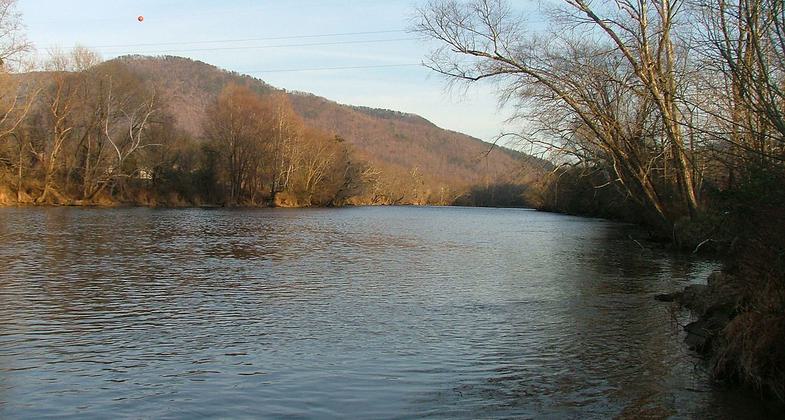
Hike along scenic Hiwassee River on the John Muir National Recreation Trail #152, which is also part of the long-distance Benton MacKaye Trail. Try a short out-and-back hike from one of the trailheads or plan a back-country trip along this 20.7-mile trail. Dispersed camping is allowed on the section of the trail located east of the Apalachia Powerhouse. Trailheads are located at Big Bend, Childers Creek, and at the end of Forest Road 108.
Accessibility Information
No text provided.
Allowed Uses:
Swimming Dogs, on leash Hiking/Walking Snow, snowshoeingOther Activities
- Camping
- Fishing
- Snow, snow play general
- Wildlife viewing / observation
Public Contact
Steve GoldmanCherokee National Forest
Ocoee/Hiwassee District
Benton, TN 37307
[email protected] • (423) 338-5201
Contact the trail manager for current maps and visiting details.
More Details
- Elevation (low): 1000
- Elevation (high): 2000
- Elevation (cumulative): --
- Part of a Trail System? No
- Surface (primary): Soil
- Surfaces (additional): Soil
- Tread Width (average): 48"
- Tread Width (minimum): --
- Running length (minimum): --
- Tread Grade (average, percent): 5
- Tread Grade (maximum): 25
- Running length (maximum): --
- Cross-slope (average, percent): --
- Cross-slope (maximum): --
- Running length (maximum): --
- Certified as an NRT
Nov 28, 1979


