Johnson Brook Trail
check with the trail manager for updated details before visiting.
Johnson Brook Trail
U.S. Fish and Wildlife Service
Backcountry Trail
- Length
3.5 miles
- Elevation Gain
--
- Route Type
Loop
(1 review)
- Length
3.5 miles - Elevation Gain
-- - Route Type
Loop
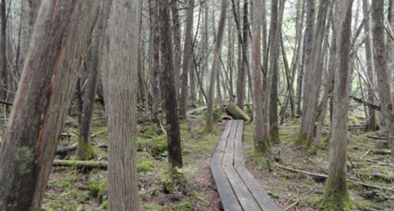
The Johnson Brook Trail is a 3.5 loop trail that traverses through a mixed hardwood/softwood forest. Numerous boardwalk sections allows visitors to experience forested wetlands.
Location: Sunkhaze Meadows National Wildlife Refuge, Maine
- States: Maine
- Counties: Penobscot
- Cities/Townships: Milford
The Johnson Brook Trail is located at the Sunkhaze Meadows National Wildlife Refuge, part of the Northern Maine NWR Complex. The trailhead is located on the County Road, eight miles from downtown Milford. The trail traverses through a mixed hardwood/softwood forest. Over 700' of boardwalk exist on the refuge. In 2015, 450' of the wooden boardwalk was replaced with an aluminum/recycled plastic boardwalk. The boardwalk allows visitors to explore the forested wetlands that surround Sunkhaze Bog.
Accessibility Information
No text provided.
Reviews
Patricia Ellis
Beautiful, but needs maintenance as of May 2024
Located within Sunkhaze National Wildlife Refuge, this is a wide path through the woods with easy walking and many lovely boardwalks. It looks like this trail once got a lot of love, with signs and benches here and there. Right now though, as of May 6, 2024, there are a lot of blowdowns, including some on the boardwalks themselves. It is possible that it is just early in the year and that the trail maintainers have not yet done their annual clean-up. Note you will need to drive very slowly on County Road to get to the trailhead as the road is gravel/dirt with tons of potholes/dips. High clearance is helpful (but not necessary as long as you drive very slowly).
Allowed Uses:
Dogs, on leash Hiking/Walking Snow, cross-country skiing Snow, snowshoeingOther Activities
- Heritage and history
- Hunting
- Snow, snow play general
- Wildlife viewing / observation
Public Contact
Steve AgiusU.S. Fish and Wildlife Service
Moosehorn NWR
Baring, ME 04694
[email protected] • (207) 454-1700
Contact the trail manager for current maps and visiting details.
More Details
- Elevation (low): --
- Elevation (high): --
- Elevation (cumulative): --
- Part of a Trail System? No
- Surface (primary): Paved
- Surfaces (additional): Boardwalk, Grass or Vegetation, Rock, crushed, Snow or ice, Soil
- Tread Width (average): 48"
- Tread Width (minimum): 36
- Running length (minimum): --
- Tread Grade (average, percent): --
- Tread Grade (maximum):
- Running length (maximum): --
- Cross-slope (average, percent): 0
- Cross-slope (maximum): --
- Running length (maximum): --
- Certified as an NRT
Jun 1, 2016


