Jones Gap
This information is a public record of the 1992 NRT application and may be out of date if it has not been updated by a trail manager --
check with the trail manager for updated details before visiting.
check with the trail manager for updated details before visiting.
Jones Gap
State
Frontcountry Trail
- Length
5.3 miles
- Elevation Gain
--
- Route Type
out & back
- Length
5.3 miles - Elevation Gain
-- - Route Type
out & back
A moderate one-mile hike from near the Jones Gap State Park Headquarters leads to this 50-foot falls descending over a rugged stone staircase.

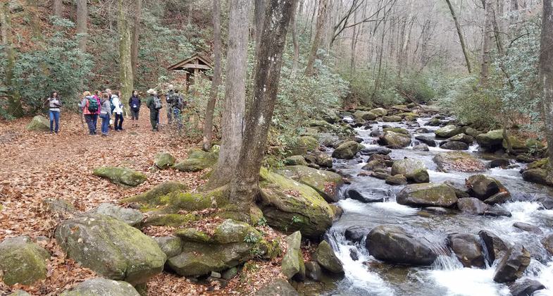
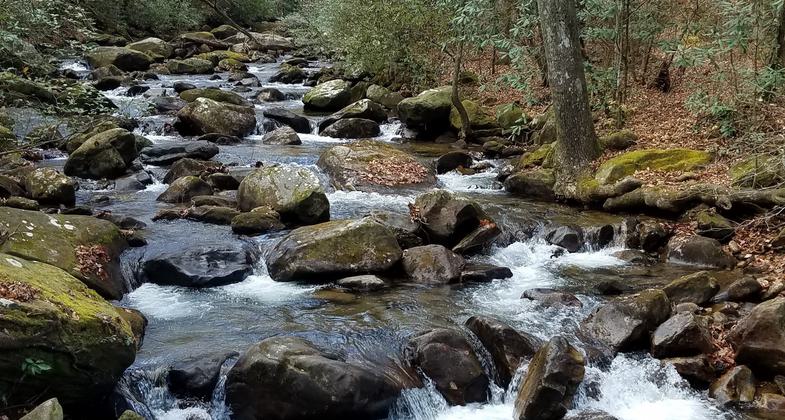
Middle Saluda River. Photo by Tasha Simon.

Middle Saluda River. Photo by Tasha Simon.

Photo by South Carolina PRT.

Photo by South Carolina PRT.

Photo by South Carolina PRT.
Location: Jones Gap State Park, Marietta, SC
- States: South Carolina
- Counties: Greenville
A moderate one-mile hike from near the Jones Gap State Park Headquarters leads to this 50-foot falls descending over a rugged stone staircase. The trail to the falls follows the boulder-strewn Middle Saluda River, which is in sight most of the way. Several pools in the river provide wading opportunities and salamander hunts. Excellent bird watching can be enjoyed on this trail.
Accessibility Information
No text provided.
Allowed Uses:
Hiking/WalkingPublic Contact
South Carolina Division of Parks1205 Pendelton St.
Columbia, SC 29201
Contact the trail manager for current maps and visiting details.
More Details
- Elevation (low): --
- Elevation (high): --
- Elevation (cumulative): --
- Part of a Trail System? No
- Surface (primary): --
- Surfaces (additional): --
- Tread Width (average): 0"
- Tread Width (minimum): --
- Running length (minimum): --
- Tread Grade (average, percent): --
- Tread Grade (maximum):
- Running length (maximum): --
- Cross-slope (average, percent): --
- Cross-slope (maximum): --
- Running length (maximum): --
- Certified as an NRT
Jul 12, 1992


