Joyce Kilmer Memorial Loop Trail
check with the trail manager for updated details before visiting.
Joyce Kilmer Memorial Loop Trail
USDA Forest Service
Backcountry Trail
- Length
2 miles
- Elevation Gain
--
- Route Type
Loop
(2 reviews)
- Length
2 miles - Elevation Gain
-- - Route Type
Loop
The figure-eight Joyce Kilmer National Recreation Trail covers two miles and has two loops.
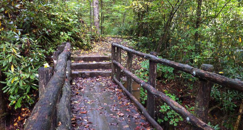
Bridge crossing on the Joyce Kilmer Memorial Loop trail. Photo by Donna Kridelbaugh.
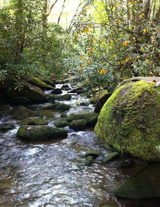
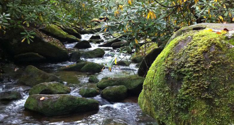
View of Little Santeetlah Creek. Photo by Donna Kridelbaugh.
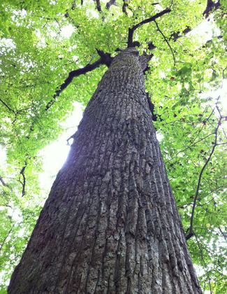
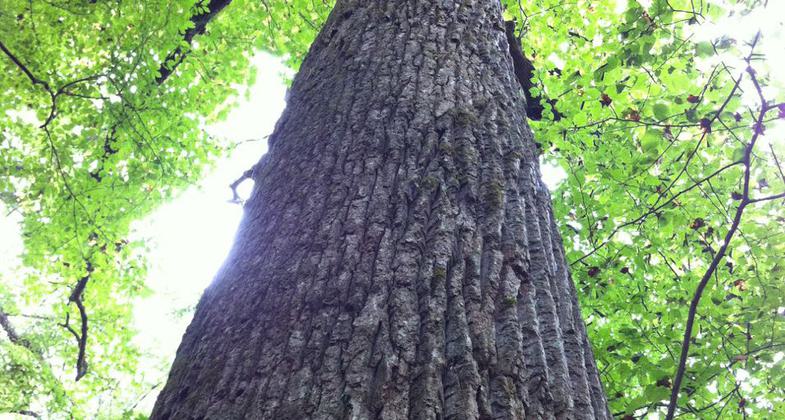
A towering forest relic in Poplar Cove. Photo by Donna Kridelbaugh.
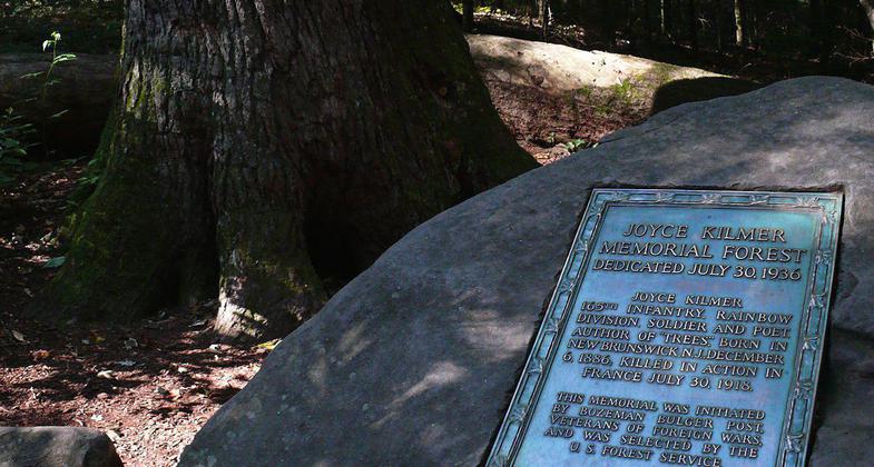
Poet Joyce Kilmer forest dedication marker. Photo by Ken Thomas/wiki.
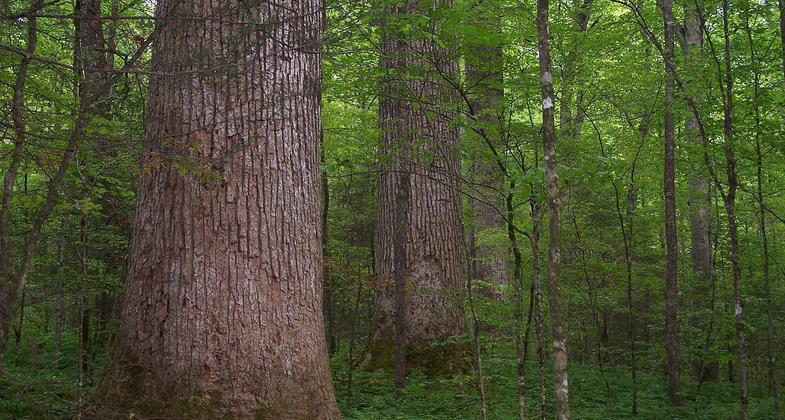
Ancient Tulip-tree grove in Joyce Kilmer Memorial Forest. Photo by Notneb82/wiki.
Location: 5410 Joyce Kilmer Road, Robbinsville, NC
- States: North Carolina
- Counties: Graham
This forest is one of the Nation's most impressive remnants of old-growth forest, containing magnificent examples of more than 100 tree species, many over 400 years old, with some more than 20 feet in circumference and over 100 feet tall. This 3,800-acre forest was set aside in 1936 as a memorial to the author of the poem "Trees," Joyce Kilmer, who was killed in action in France during World War I. This forest, part of the Joyce Kilmer-Slick Rock Wilderness, is maintained in its primitive state.
The only way to see the impressive memorial forest is on foot. The figure-eight Joyce Kilmer Memorial Loop National Recreation Trail covers two miles and has two loops: the 1.25-mile lower loop passes the Joyce Kilmer Memorial plaque, and the upper 0.75-mile loop swings through Poplar Cove - a grove of the forest's largest trees. The trailhead parking area has a flush toilet (seasonal) and picnic tables. A privy-type outhouse is available year-round. No camping or overnight parking is allowed.
Accessibility Information
No text provided.
Reviews
Dick
Trail Update
The portion of the lower loop that was closed is now open to hikers.
Donna Kridelbaugh
NRT Ambassador Review
The Joyce Kilmer Memorial Loop Trail is a two-mile, double-loop trail that leads hikers on an awe-inspiring journey through remnant virgin forest spared from logging long ago. The Upper Loop segment is lined with towering trees that seem to touch the sky and bursts with wildflowers in the spring. There are some steep grade changes with multiple, short up-and-down sections. Wooden bridges are installed for major water crossings. Before entering the trail, you can learn more about the poet Joyce Kilmer at the trailhead kiosk and recite his poem"Trees", which is a fitting tribute to honor the forest relics that have thrived in this cherished place. The parking lot has ample parking spaces, a picnic area and restroom facilities. The area also serves as a portal to the congressionally designated Joyce Kilmer-Slickrock Wilderness area, which is maintained in a more primitive and natural condition. As such, no mechanized or motorized equipment or vehicles (e.g., strollers, wheeled coolers) are permitted. The loop trail intersects with the Naked Ground Trail, which is a rugged, backcountry trail into the wilderness, so be sure to follow the signed juncture accordingly to stay on the loop trail. As the memorial forest is a popular destination, the impacts of so many people over time has caused soil compaction/erosion. This has exposed large root systems and creates slick, muddy conditions, so exercise caution when hiking. To protect this place for others' enjoyment, please leave no trace and try to visit in small groups, stay on the trail and pack out your trash. The trail is primarily maintained by the local nonprofit Partners of Joyce Kilmer-Slickrock Wilderness. Check out their website for upcoming events and volunteer opportunities. Note: Part of the Lower Loop washed out during heavy rains in early 2020 and that section of trail will be closed until repairs can be made. The Upper Loop can still be accessed by following the Lower Loop segment that remains open.
Allowed Uses:
Hiking/WalkingOther Activities
- Hunting
- Wildlife viewing / observation
Public Contact
Nantahala National ForestCheoah Ranger District
Robbinsville, NC 28771
(828) 479-6431
www.fs.usda.gov/nfsnc
Contact the trail manager for current maps and visiting details.
More Details
- Elevation (low): 2207
- Elevation (high): 2553
- Elevation (cumulative): --
- Part of a Trail System? No
- Surface (primary): Soil
- Surfaces (additional): Boardwalk
- Tread Width (average): 30"
- Tread Width (minimum): --
- Running length (minimum): --
- Tread Grade (average, percent): 10
- Tread Grade (maximum): 25
- Running length (maximum): --
- Cross-slope (average, percent): --
- Cross-slope (maximum): --
- Running length (maximum): --
- Certified as an NRT
Mar 5, 1979

