Jubilee Lake
This information is a public record of the 1981 NRT application and may be out of date if it has not been updated by a trail manager --
check with the trail manager for updated details before visiting.
check with the trail manager for updated details before visiting.
Jubilee Lake
USDA Forest Service
Backcountry Trail
- Length
3 miles
- Elevation Gain
--
- Route Type
out & back
- Length
3 miles - Elevation Gain
-- - Route Type
out & back

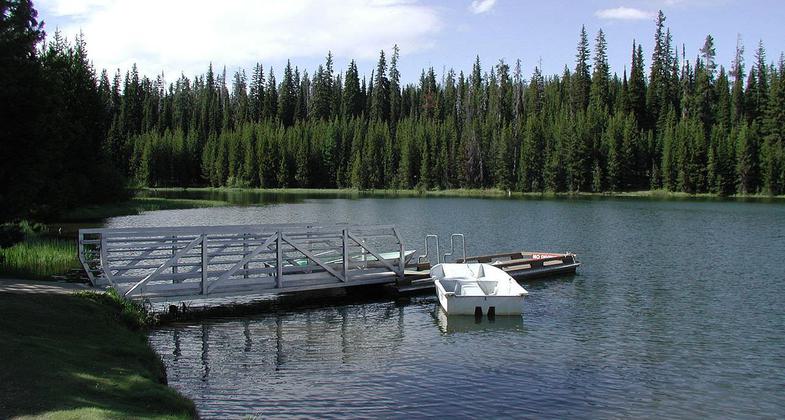
A metal and wooden dock and a small white boat floating beside in shallow water. Photo by USFS.
Location: Umatilla National Forest, Walla Walla Road, In Umatilla National Forest, E of Pendleton, goes around lake from Jubilee Lake Campground.
- States: Oregon
- Counties: Union
This 2.6 mile scenic trail loops around Jubilee Lake and begins and ends at the lake's boat ramp. The path is open to hikers and offers barrier free access.
Accessibility Information
No text provided.
Allowed Uses:
Hiking/WalkingPublic Contact
Jeff BloomUS Forest Service
1415 W. Rose St.
Walla Walla, WA 99362
[email protected] • (509) 522-6277
Contact the trail manager for current maps and visiting details.
More Details
- Elevation (low): --
- Elevation (high): --
- Elevation (cumulative): --
- Part of a Trail System? No
- Surface (primary): Soil
- Surfaces (additional): --
- Tread Width (average): 54"
- Tread Width (minimum): --
- Running length (minimum): --
- Tread Grade (average, percent): --
- Tread Grade (maximum):
- Running length (maximum): --
- Cross-slope (average, percent): --
- Cross-slope (maximum): --
- Running length (maximum): --
- Certified as an NRT
Mar 3, 1981

