King Range Trail
check with the trail manager for updated details before visiting.
King Range Trail
Bureau of Land Management
Backcountry Trail
- Length
10 miles
- Elevation Gain
--
- Route Type
out & back
- Length
10 miles - Elevation Gain
-- - Route Type
out & back
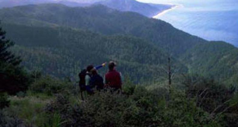
Spectacular mountain trails with wide ocean views in northern California's Mendicino County. The King Range contains over 70 miles of hiking trails spanning from the beach to the highest peaks. Most of the upland trails are strenuous due to the steep rugged nature of the area.
Location: Above the Pacific coast near Ettersberg and Whitethorn.
- States: California
The King Range National Recreation Trail is managed by the Bureau of Land Management from the Arcata Field Office in the King Range National Conservation Area. Trail scenery includes coast walking as well as mountain meadows, old-growth forests, and ridgetop vistas. Routes through coastal chaparral offer hikers an interesting contrast to the northern leg of the Lost Coast Trail. Hikers can also continue for 22 more miles through redwood groves and fern-clad glens of Sinkyone Wilderness State Park.
A spectacular meeting of land and sea is certainly the dominant feature of the King Range National Conservation Area. Mountains seem to thrust straight out of the surf; a precipitous rise unsurpassed on the continental U.S. coastline. King Peak, the highest point at 4,087 feet, is only three miles from the ocean.
The King Range contains over 70 miles of hiking trails spanning from the beach to the highest peaks. Most of the upland trails are strenuous due to the steep rugged nature of the area. In addition to mileage, pay attention to the elevation changes listed in the trail descriptions. A number of connector trails allow for loop hikes (Saddle Mountain, Rattlesnake Ridge, Buck Creek Loop Hike) taking in the King Crest and Lost Coast Beach. The BLM maintains the King Range backcountry as a wilderness setting, so expect no facilities and minimal signing on trails.
Permits are now required for overnight use on both the Lost Coast Trail and all trails in the King Range Wilderness Area/King Range National Conservation Area and can be obtained online from www.recreation.gov. There is no permit or fee required for day use, however, most of the backcountry trails and popular areas aren't accessible for day hiking as there are no roads. A topo map showing trails, permits, a day hike list and other useful information for visiting can be found on the King Range NCA website at https://www.blm.gov/programs/national-conservation-lands/california/king-range-national-conservation-area and on the Recreation.gov website at https://www.recreation.gov/permits/72192.
Questions can be directed to the Bureau of Land Management, King Range NCA Visitor Center (707) 986-5400.
The King Range Crest Trail has been designated a National Recreational Trail. It was certified in 1971, one of the first trails in the United States to be so honored.
Accessibility Information
No text provided.
Allowed Uses:
Hiking/WalkingPublic Contact
Bureau of Land ManagementKing Range NCA Visitor Center
555 Leslie St.
Ukiah, CA 95482
(707) 986-5400
www.blm.gov/visit/king-range-national-conservation-area
Contact the trail manager for current maps and visiting details.
More Details
- Elevation (low): --
- Elevation (high): --
- Elevation (cumulative): --
- Part of a Trail System? No
- Surface (primary): --
- Surfaces (additional): --
- Tread Width (average): 0"
- Tread Width (minimum): --
- Running length (minimum): --
- Tread Grade (average, percent): --
- Tread Grade (maximum):
- Running length (maximum): --
- Cross-slope (average, percent): --
- Cross-slope (maximum): --
- Running length (maximum): --
- Certified as an NRT
Jun 1, 1971


