Kings River Trail
check with the trail manager for updated details before visiting.
Kings River Trail
USDA Forest Service
Backcountry Trail
- Length
3 miles
- Elevation Gain
--
- Route Type
out & back
- Length
3 miles - Elevation Gain
-- - Route Type
out & back
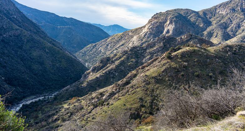
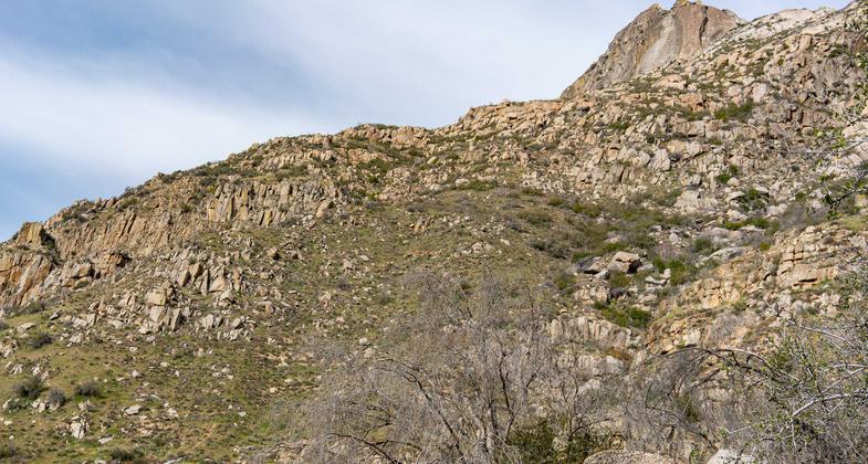
The trail meadows gently along the lower Kings River, below spectacular granite formations.

Looking west from high on the Kings River National Recreation Trail near Garlic Spur. Photo by Paul Martzen.

Garlic Dome, high above the trail near Garlic Spur. Photo by Paul Martzen.

Looking east up the Kings River from near Spring Creek. Photo by Paul Martzen.
Location: Rural, In Sierra National Forest, begins at Garnet Dike Campground.
- States: California
- Counties: Madera
The Kings River is one of the most stunning rivers of the Sierra Nevada, forming the border between the Sierra and Sequoia National Forests and originating in the high country of Sequoia/Kings Canyon National Parks. Within the Sierra National Forest, elevations along the river range from 800 feet at Pine Flat Reservoir to over 10,000 feet at Spanish Mountain. A variety of vegetation types can be observed due to the geographic location and extreme topography of the Kings River area; annual grasslands to riparian woodlands to ponderosa pine forests can be seen along this hike. Granitic, metamorphic, and carbonate soils contribute to the diversity of plant species that can be seen in this area.
The Kings River Trail follows the river upstream for approximately six miles, first traversing grasslands and riverbanks with Mexican poppies, globe gilia, caterpillar phacelia, and blazing stars. Riparian vegetation is resplendent with California sycamores, buttonwillow, and western spicebush, among others. Interspersed throughout are common species like bush lupine, fiddlenecks, popcorn flowers, and red maids. In areas with carbonate soils (limestone), the Kings River buckwheat may be found. Recommended viewing time is from March to May. November is a good time to see the Kings River buckwheat. The trail eventually winds up the slope and dead-ends in drainage above the river.
As of 2022, the trail is in good condition all the way to Garlic Spur, about 5.4 miles from the trailhead. The trail is presently being maintained by the Mountain Warriors volunteer trail crew.
Accessibility Information
No text provided.
Allowed Uses:
Bicycling Dogs, on leash Equestrian Hiking/WalkingOther Activities
- Camping
- Fishing
- Wildlife viewing / observation
Public Contact
Marty SchrammSierra National Forest
1600 Tollhouse Rd.
Clovis, CA 93611
(559) 855-5355
Contact the trail manager for current maps and visiting details.
More Details
- Elevation (low): --
- Elevation (high): --
- Elevation (cumulative): --
- Part of a Trail System? No
- Surface (primary): --
- Surfaces (additional): --
- Tread Width (average): 36"
- Tread Width (minimum): --
- Running length (minimum): --
- Tread Grade (average, percent): --
- Tread Grade (maximum):
- Running length (maximum): --
- Cross-slope (average, percent): --
- Cross-slope (maximum): --
- Running length (maximum): --
- Certified as an NRT
Nov 26, 1979

