La Framboise Island
This information is a public record of the 1981 NRT application and may be out of date if it has not been updated by a trail manager --
check with the trail manager for updated details before visiting.
check with the trail manager for updated details before visiting.
La Framboise Island
U.S. Corps of Engineers
Backcountry Trail
- Length
7 miles
- Elevation Gain
--
- Route Type
out & back
- Length
7 miles - Elevation Gain
-- - Route Type
out & back
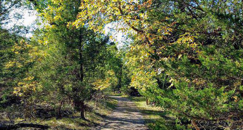
Flat path around island forested with cottonwoods, cedar and ash.

A refuge from the wind anytime of the year. A great place to hike or mountain bike single-track trails. Photo by Rod Kranzler.
Location: rural On Framboise Island in Missouri R near downtown Pierre.
- States: South Dakota
- Counties: Hughes
LaFramboise Island Nature Area is a unique area along the Missouri River in the capital city, Pierre. The island is covered in trees and meadows, which are home to a variety of wildlife and bird species. Additionally, the island is mentioned in the Lewis and Clark journals as they passed through the area in 1804. Facilities include hiking and biking trails, a boat ramp, a fishing dock, and a picnic shelter.
Accessibility Information
No text provided.
Allowed Uses:
Hiking/WalkingPublic Contact
Phil SheffieldUS Army Corps of Engineers
28563 Powerhouse Rd.
Pierre, SD 57501
[email protected] • (605) 224-5862
Contact the trail manager for current maps and visiting details.
More Details
- Elevation (low): --
- Elevation (high): --
- Elevation (cumulative): --
- Part of a Trail System? No
- Surface (primary): --
- Surfaces (additional): --
- Tread Width (average): 72"
- Tread Width (minimum): --
- Running length (minimum): --
- Tread Grade (average, percent): --
- Tread Grade (maximum):
- Running length (maximum): --
- Cross-slope (average, percent): --
- Cross-slope (maximum): --
- Running length (maximum): --
- Certified as an NRT
May 4, 1981


