Lady Finger Bluff Trail
check with the trail manager for updated details before visiting.
Lady Finger Bluff Trail
Other Federal
Backcountry Trail
- Length
2.7 miles
- Elevation Gain
--
- Route Type
Loop
(1 review)
- Length
2.7 miles - Elevation Gain
-- - Route Type
Loop
Lady's Bluff Trail is a TVA managed trail that is also a National Recreation Trail located near the Kentucky Lake.

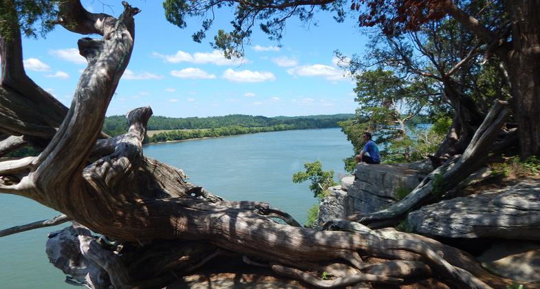
View from Lady Finger Bluff overlook https://www.facebook.com/nashvillehiking. Photo by Nashville Hiking.

Scenic overlook hiker. Photo by Jessica Stevens.
Location: north of US Highway 412 along east side of Tennessee Lake.
- States: Tennessee
- Counties: Perry
Note: The trail often floods because of its location on the Kentucky Reservoir of the Tennessee River. Check with trail management for current conditions before heading out. The trail follows the shoreline of the Lick Creek embayment to emerge on high bluffs that offer a spectacular view of Kentucky Reservoir. Features include ancient cedar trees, limestone outcroppings, streams, upland hardwood forests, and a fine vantage point from which to observe migrating waterfowl at the Tennessee National Wildlife Refuge on the opposite shore.
Accessibility Information
No text provided.
Reviews
Fawn Walden
September 19, 2018
We got to the trail sign about 9 am. We saw one blue trail marker on a tree near the sign. That was the only one to be seen but we followed the trail of trash up to the first set of steps. Wandered off the trail as there wasn't any markers of any kind to be seen. With twists and turns a short hike turned in to something more. When we finally made it up to the bluff. We didn't get to see much as there was a crowd of people on one and someone was cooking on the other it looked like they were camping . We did find a quiet area to sit and rest before starting back. There was a trail marker that led off to one side and we followed that until we realized that if was the wrong way but it was marked. .. If we go again we will take a larger trash bag to carry out the trash.
Allowed Uses:
Hiking/WalkingPublic Contact
Tennessee Valley Authority Public Land Information, (800) 882-5263
www.tva.com/Environment/Environmental-Stewardship/Public-Lands-Info
Contact the trail manager for current maps and visiting details.
More Details
- Elevation (low): --
- Elevation (high): --
- Elevation (cumulative): --
- Part of a Trail System? No
- Surface (primary): Soil
- Surfaces (additional): --
- Tread Width (average): 0"
- Tread Width (minimum): --
- Running length (minimum): --
- Tread Grade (average, percent): --
- Tread Grade (maximum):
- Running length (maximum): --
- Cross-slope (average, percent): --
- Cross-slope (maximum): --
- Running length (maximum): --
- Certified as an NRT
Dec 27, 1977

