Lassen Peak
check with the trail manager for updated details before visiting.
Lassen Peak
National Park Service
Backcountry Trail
- Length
2.5 miles
- Elevation Gain
--
- Route Type
out & back
- Length
2.5 miles - Elevation Gain
-- - Route Type
out & back
The trail to the top of Lassen Peak begins at the peak parking area at an elevation of 8500 feet. The popular trail is 2.5 miles one-way to the summit.
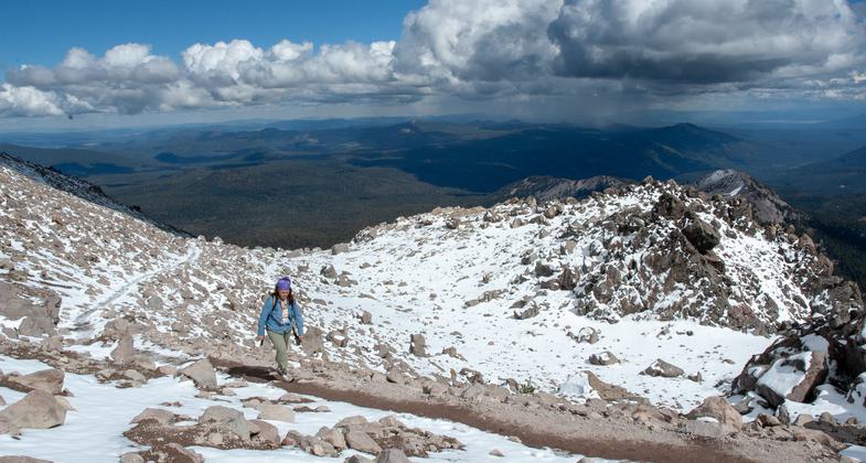
Approaching the top. Photo by Mike Bullington.
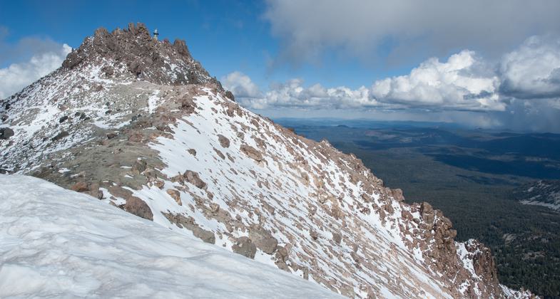
At the top. Photo by Mike Bullington.

View of the Devastated Area from Lassen Peak. Photo by NPS.
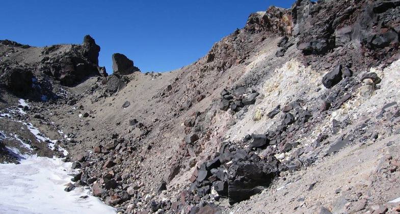
Crater on Lassen Peak Trail. Photo by NPS.
Location: In Lassen National Park, connects park road to Lassen Peak.
- States: California
- Counties: Shasta
The trail to the top of Lassen Peak begins at the peak parking area at an elevation of 8500 feet. The popular trail is 2.5 miles one-way to the summit. There are many fantastic vistas of the park and surrounding areas from the trail (see picture gallery below). The summit provides one of the most spectacular views of the Devastated Area, a view from the top looking down (see picture). This view is the best vantage point to contemplate the power of the 1914-17 eruptions. The lingering rotten-egg smell of hydrogen sulfide near the summit reminds visitors that Lassen is still considered an active, but dormant, volcano.
There are many switchbacks and the trail can be steep and rocky at times. Hiking boots are recommended. A round trip takes 3 to 5 hours.
A vehicle pass is required for all vehicles entering the park.
Accessibility Information
No text provided.
Allowed Uses:
Hiking/WalkingPublic Contact
Stuart NussLassen Volcanic National Park
P.O. Box 100
Mineral, CA 96063
Contact the trail manager for current maps and visiting details.
More Details
- Elevation (low): 8500
- Elevation (high): 10450
- Elevation (cumulative): --
- Part of a Trail System? No
- Surface (primary): Soil
- Surfaces (additional): --
- Tread Width (average): 0"
- Tread Width (minimum): --
- Running length (minimum): --
- Tread Grade (average, percent): --
- Tread Grade (maximum):
- Running length (maximum): --
- Cross-slope (average, percent): --
- Cross-slope (maximum): --
- Running length (maximum): --
- Certified as an NRT
Mar 19, 1981