Lauterman Trail
check with the trail manager for updated details before visiting.
Lauterman Trail
USDA Forest Service
Backcountry Trail
- Length
9 miles
- Elevation Gain
--
- Route Type
out & back
- Length
9 miles - Elevation Gain
-- - Route Type
out & back
If you like to canoe, fish, hike, or mountain bike then the Lauterman National Recreation Area is the place for you.

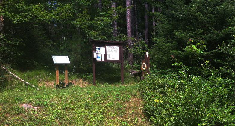
Trailhead and signage. Photo by Dan Gayhart.

A popular trail system for hiking, biking and cross-country skiing. Photo by Dan Gayhart.
Location: T 40 NR 16E Sec 28, 29, 30, 31, near Florence.
- States: Wisconsin
- Counties: Florence
This trail traverses some hilly terrain and offers good hiking and mountain biking opportunities, as well as being groomed for cross-country skiing (traditional). It includes three loops with one loop for beginning skiers. Five walk-in campsites are located around Lauterman Lake complete with tables, tent pads, fire rings, and wilderness-style toilets. If the fish are biting, you may find yourself hooking northern pike, bass, perch, and panfish. An added feature is an Adirondack-style shelter that provides a rest or picnic stop for hikers and skiers alike. This trail connects with Perch Lake to the north and the Pine River and Chipmunk Rapids Campground to the south. A trail map is available at the trailhead.
Accessibility Information
No text provided.
Allowed Uses:
Bicycling Equestrian Hiking/Walking Snow, cross-country skiing Snow, snowshoeingOther Activities
- Camping
- Fishing
- Snow, snow play general
- Wildlife viewing / observation
Public Contact
Jeff HerrettUS Forest Service
4364 Wall St.
Eagle River, WI 54521
jherrett/[email protected] • (715) 479-2827
www.fs.fed.us/r9/cnnf
Contact the trail manager for current maps and visiting details.
More Details
- Elevation (low): 1460
- Elevation (high): 1550
- Elevation (cumulative): --
- Part of a Trail System? No
- Surface (primary): Soil
- Surfaces (additional): Soil
- Tread Width (average): 36"
- Tread Width (minimum): --
- Running length (minimum): --
- Tread Grade (average, percent): 5
- Tread Grade (maximum): 30
- Running length (maximum): --
- Cross-slope (average, percent): --
- Cross-slope (maximum): --
- Running length (maximum): --
- Certified as an NRT
Dec 12, 1979

