Lava Cast Forest
This information is a public record of the 1981 NRT application and may be out of date if it has not been updated by a trail manager --
check with the trail manager for updated details before visiting.
check with the trail manager for updated details before visiting.
Lava Cast Forest
USDA Forest Service
Backcountry Trail
- Length
0.9 miles
- Elevation Gain
--
- Route Type
out & back
- Length
0.9 miles - Elevation Gain
-- - Route Type
out & back
In the Newberry National Volcanic Monument.

The Lava Cast Forest Trail is a paved, barrier-free interpretive trail. Photo by Linda Thomas and Lane Thomas.

Wildflowers growing out of lava flow. Photo by Linda Thomas and Lane Thomas.

The Lava Cast Forest Trail is a paved, barrier-free interpretive trail. Photo by Linda Thomas and Lane Thomas.
Location: In Deschutes National Forest, S of Bend on US 97.
- States: Oregon
- Counties: Deschutes
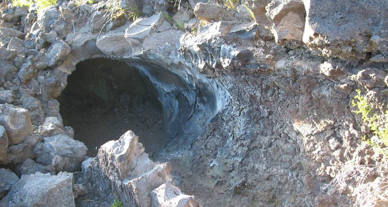
The Lava Cast Forest Trail is a paved, barrier-free interpretive trail. The trail goes through a lava flow in which there are log casts of standing trees from when the lava flow occurred. There are a couple of sections on the trail that may be difficult for wheelchair accessibility.
Accessibility Information
No text provided.
Allowed Uses:
Hiking/WalkingPublic Contact
Marv LangDeschutes National Forest
1230 NE 3rd St., Ste. A262
Bend, OR 97701
[email protected] • (541) 383-4793
www.fs.fed.us/r6/centraloregon
Contact the trail manager for current maps and visiting details.
More Details
- Elevation (low): 5750
- Elevation (high): 5850
- Elevation (cumulative): --
- Part of a Trail System? No
- Surface (primary): Paved
- Surfaces (additional): Paved
- Tread Width (average): 24"
- Tread Width (minimum): --
- Running length (minimum): --
- Tread Grade (average, percent): 3
- Tread Grade (maximum): 6
- Running length (maximum): --
- Cross-slope (average, percent): --
- Cross-slope (maximum): --
- Running length (maximum): --
- Certified as an NRT
May 14, 1981

