Left Fork Huntington Creek
This information is a public record of the 1979 NRT application and may be out of date if it has not been updated by a trail manager --
check with the trail manager for updated details before visiting.
check with the trail manager for updated details before visiting.
Left Fork Huntington Creek
USDA Forest Service
Backcountry Trail
- Length
5.8 miles
- Elevation Gain
--
- Route Type
out & back
- Length
5.8 miles - Elevation Gain
-- - Route Type
out & back

Photo by Richard Warnick, USFS.

Left Fork Hungtington Creek Seely Fire burn area.

Left Fork Huntington Creek.

Left Fork Huntington Creek.

Snowshoeing along Left Fork Huntington Creek. Photo by Rich Warnick.
Location: On Manti-La Sal NF, W of Huntington above SR 31.
- States: Utah
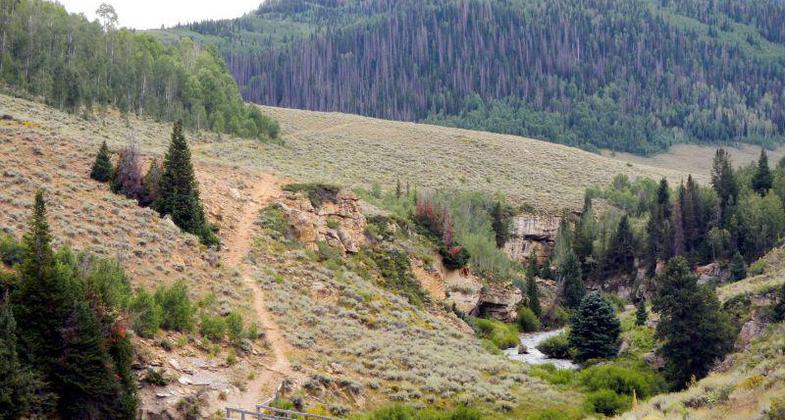
Trailhead at Miller Flat begins in sagbrush/grass and the continues the rest of the way through scenic stands of spruce and fir. This trail is normally hiked from Miller Flat Trailhead down to the Forks of Huntington.
Accessibility Information
No text provided.
Allowed Uses:
Dogs, on leash Hiking/WalkingOther Activities
- Camping
- Fishing
Public Contact
Manti-La Sal National Forest599 West Price River Dr.
Price, UT 84501
/[email protected]
Contact the trail manager for current maps and visiting details.
More Details
- Elevation (low): --
- Elevation (high): --
- Elevation (cumulative): --
- Part of a Trail System? No
- Surface (primary): --
- Surfaces (additional): --
- Tread Width (average): 18"
- Tread Width (minimum): --
- Running length (minimum): --
- Tread Grade (average, percent): --
- Tread Grade (maximum):
- Running length (maximum): --
- Cross-slope (average, percent): --
- Cross-slope (maximum): --
- Running length (maximum): --
- Certified as an NRT
Sep 13, 1979

