Lester Park Nature Trail
check with the trail manager for updated details before visiting.
Lester Park Nature Trail
City, Town, or County
Backcountry Trail
- Length
1 mile
- Elevation Gain
--
- Route Type
Loop
- Length
1 mile - Elevation Gain
-- - Route Type
Loop
The Lester Park Nature Trail is a continuous loop of nearly one mile.
Location: 61st Ave East and Superior Street, Duluth, MN
- States: Minnesota
- Counties: St. Louis
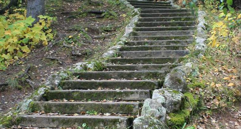
The trail first travels up the West Branch of the Lester River, then cuts across Lester Park and follows the East Branch down to the confluence of the two branches. The Lester River is a popular trout stream. Along the way, the trail user crosses over several rustic, stone bridges constructed by the Work Projects Administration.
An interpretive brochure describes how the creek has carved its path through the dark basalt that was formed by volcanic flows a billion years ago. Balsam fir, white pine, aspen and birch are among the tree species of the area, and a section of the trail passes through a popular feeding spot for deer, moose, and rabbits. The trail is principally designed for nature walks, but there is some use by skiers and snowshoers.
Accessibility Information
No text provided.
Allowed Uses:
Bicycling Hiking/Walking Snow, cross-country skiingOther Activities
- Snow, snow play general
Public Contact
Duluth Parks and Recreation411 W 1st Street
Duluth, MN 55802
(218)730-5000
duluthmn.gov/park
Contact the trail manager for current maps and visiting details.
More Details
- Elevation (low): --
- Elevation (high): --
- Elevation (cumulative): --
- Part of a Trail System? No
- Surface (primary): Paved
- Surfaces (additional): Soil
- Tread Width (average): --"
- Tread Width (minimum): --
- Running length (minimum): --
- Tread Grade (average, percent): --
- Tread Grade (maximum):
- Running length (maximum): --
- Cross-slope (average, percent): --
- Cross-slope (maximum): --
- Running length (maximum): --
- Certified as an NRT
Sep 22, 1975


