Lewis Creek Trail
check with the trail manager for updated details before visiting.
Lewis Creek Trail
USDA Forest Service
- Length
3.7 miles
- Elevation Gain
--
- Route Type
out & back
- Length
3.7 miles - Elevation Gain
-- - Route Type
out & back
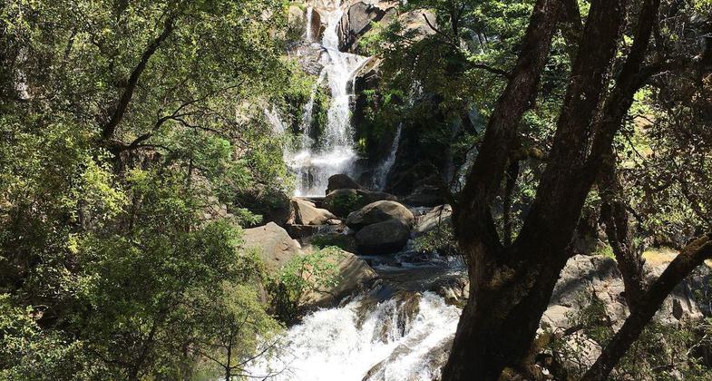
Red rock coral falls, Corlieu warm springs and the old lumber flume route.
Location: In Sierra NF, S from Fish Camp/Sugar Pine along SR 41.
- States: California
- Counties: Madera
The Lewis Creek National Scenic Trail to Corlieu Falls and Red Rock Falls is a 3.7-mile moderately trafficked out-and-back trail located near Oakhurst, California that features waterfalls, and beautiful spring flora and is rated as moderate. The trail offers a number of activity options and is best used from March until November. Dogs are also able to use this trail but must be kept on a leash.
Follow the trail along a historic lumber flume route (some remnants can be seen). Sugar Pine Lumber Company used the enormous flume to float milled lumber more than 50 miles to the town of Madera. Corlieu and Red Rock waterfalls please the spirit, as well as, beautiful flora in the spring as you travel this moderate to steep North/South trail. There is a gain of 977 feet in elevation.
Accessibility Information
No text provided.
Allowed Uses:
Hiking/WalkingPublic Contact
Sierra National Forest1600 Tollhouse
Clovis, CA 93611
(559) 297-0706
Contact the trail manager for current maps and visiting details.
More Details
- Elevation (low): --
- Elevation (high): 977
- Elevation (cumulative): --
- Part of a Trail System? No
- Surface (primary): --
- Surfaces (additional): --
- Tread Width (average): 0"
- Tread Width (minimum): --
- Running length (minimum): --
- Tread Grade (average, percent): --
- Tread Grade (maximum):
- Running length (maximum): --
- Cross-slope (average, percent): --
- Cross-slope (maximum): --
- Running length (maximum): --
- Certified as an NRT
Mar 28, 1982


