Limestone County Canoe & Kayak Trail
check with the trail manager for updated details before visiting.
Limestone County Canoe & Kayak Trail
City, Town, or County
Water Trail (other)
- Length
21.9 miles
- Elevation Gain
--
- Route Type
out & back
- Length
21.9 miles - Elevation Gain
-- - Route Type
out & back
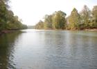
The beautiful Elk River is the perfect place for canoeing and kayaking in Limestone County, Alabama. The water is challenging and the scenery is beautiful. As you travel the Elk River in the fall, you will see the beautiful fall colors, especially during October. In the spring, the white dogwood and redbud trees, blooming along the riverbanks, are breathtaking.
Location: Elk River
- States: Alabama
- Counties: Limestone
The beautiful Elk River is the perfect place for canoeing and kayaking in Limestone County, Alabama. The water is challenging and the scenery is beautiful. As you travel the Elk River in the fall, you will see beautiful fall colors, especially during October. In the spring, the white dogwood and redbud trees, blooming along the riverbanks, are breathtaking.
A Class 1 stream, with towering bluffs, untouched forests, and rolling meadows. The route begins at Elkmont, Alabama just west of I-65 at Exit 361. It is 21.9 miles along the scenic Elk River with five easy in-and-out points. Elk River water levels are TVA Dam controlled, which means good canoeing even during dry summers.
Accessibility Information
No text provided.
Allowed Uses:
SwimmingOther Activities
- Camping
- Fishing
- Wildlife viewing / observation
Public Contact
Michael NaveLimestone County Parks & Recreation
310 West Washington St.
Athens, AL 35611
[email protected] • (256) 216-3425
www.limestoneparks.com
More Details
- Elevation (low): 583
- Elevation (high): 600
- Elevation (cumulative): --
- Part of a Trail System? No
- Surface (primary): Water, slow moving
- Surfaces (additional): --
- Tread Width (average): --"
- Tread Width (minimum): --
- Running length (minimum): --
- Tread Grade (average, percent): --
- Tread Grade (maximum):
- Running length (maximum): --
- Cross-slope (average, percent): --
- Cross-slope (maximum): --
- Running length (maximum): --
- Certified as an NRT
May 2, 2010


