Linville Falls Trail
This information is a public record of the 1981 NRT application and may be out of date if it has not been updated by a trail manager --
check with the trail manager for updated details before visiting.
check with the trail manager for updated details before visiting.
Linville Falls Trail
National Park Service
Backcountry Trail
- Length
1.2 miles
- Elevation Gain
--
- Route Type
out & back
- Length
1.2 miles - Elevation Gain
-- - Route Type
out & back
Location: At Linville Falls on Blue Ridge Parkway at milepost 316.4.
- States: North Carolina
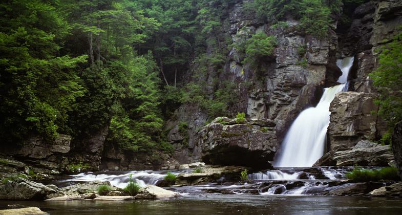
Linville Falls is located on the Blue Ridge Parkway. Trails lead to views of both the upper and lower falls. Forests offer virgin hemlock mixed with other familiar trees such as white pine, oaks, hickory, and birch. A colorful and varied display of wildflowers decorates the trails in the spring. Red and golden leaves in fall beautifully contrast with the soothing green of hemlocks.
Accessibility Information
No text provided.
Allowed Uses:
Hiking/WalkingPublic Contact
Blue Ridge Parkway NPS199 Hemphill Knob Road
Asheville, NC 28803
(828) 348-3400
www.nps.gov/blri/index.htm
Contact the trail manager for current maps and visiting details.
More Details
- Elevation (low): --
- Elevation (high): --
- Elevation (cumulative): --
- Part of a Trail System? No
- Surface (primary): Soil
- Surfaces (additional): Rock, smooth
- Tread Width (average): 0"
- Tread Width (minimum): --
- Running length (minimum): --
- Tread Grade (average, percent): --
- Tread Grade (maximum):
- Running length (maximum): --
- Cross-slope (average, percent): --
- Cross-slope (maximum): --
- Running length (maximum): --
- Certified as an NRT
Nov 26, 1981


