Little Cherry Pond Trail
check with the trail manager for updated details before visiting.
Little Cherry Pond Trail
U.S. Fish and Wildlife Service
Backcountry Trail
- Length
1 mile
- Elevation Gain
--
- Route Type
out & back
(1 review)
- Length
1 mile - Elevation Gain
-- - Route Type
out & back

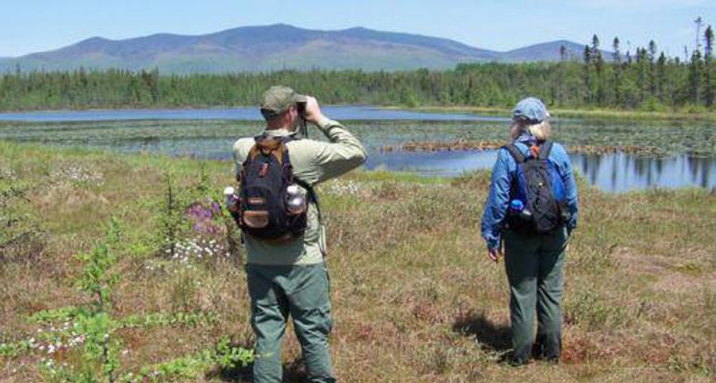
Wildlife watching at Little Cherry Pond.

View from Cherry Pond. Photo by Janie Walker.

On the way to the trailhead. Photo by Janie Walker.

Part of the trail. Photo by Janie Walker.

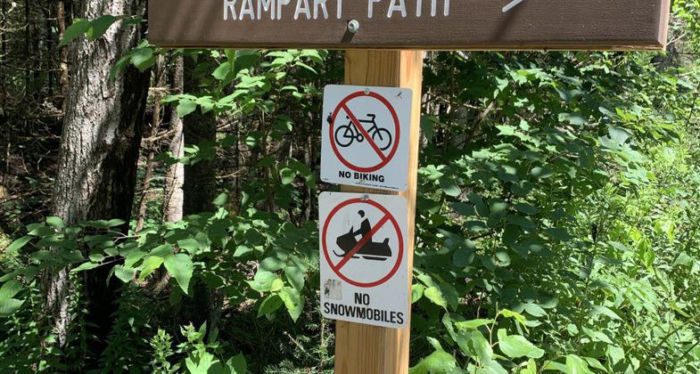
trail sign. Photo by Janie Walker.
Location: Pondicherry Division of Silvio O. Conte National Fish and Wildlife Refuge
- States: New Hampshire
- Counties: Coos
The Little Cherry Pond Trail begins on an ice push rampart at the edge of Cherry Pond, a 100-acre pond teeming with wildlife and offering spectacular views of the Presidential Range of the White Mountains. At the end of the trail at Little Cherry Pond, there is a viewing platform where moose, beaver, otter, waterfowl, and osprey are often seen. The Little Cherry Pond provides a fascinating walk through the heart of the Silvio O. Conte National Wildlife Refuge. It winds through six different forest communities including black spruce, tamarack, balsam fir, aspen, and Black Spruce-Tamarack Boreal Bog.
Accessibility Information
No text provided.
Reviews
Janie Walker
Little Cherry Pond +
This is a pretty standard trail that leads to a large pond with beautiful views. The location of this trail is within the Pondicherry Wildlife Refuge (NH), and you have to walk 1.5 miles of the Presidential Rail Trail (from Airport Road of Route 115) and then along a historic railway to get to the trailhead. Gorgeous views surround you while you make your way to the trailhead (once you reach those rail tracks). Note - most of the rail trail is just a straight trail that seems to go on forever with no views. Be patient and keep walking. Your walking will pay off, promise, once you reach the viewing platform and/or rail tracks. The five-star rating is for the view not just at Little Cherry Pond, but on the way to get to the trailhead (once at and past the viewing platform). Also, this is a bird-watcher's paradise.
Allowed Uses:
Hiking/WalkingOther Activities
- Wildlife viewing / observation
Public Contact
Barry ParrishUS Fish and Wildlife Service
103 East Plumtree Road
Sunderland, MA 01375
[email protected] • (413) 548-8002
www.fws.goc/r5soc
Contact the trail manager for current maps and visiting details.
More Details
- Elevation (low): 1110
- Elevation (high): 1120
- Elevation (cumulative): --
- Part of a Trail System? No
- National Designations: National Natural Landmark
- State Designations: Connecticut River Birding Trail<comma> Importand B
- Surface (primary): Soil
- Surfaces (additional): Soil
- Tread Width (average): 18"
- Tread Width (minimum): --
- Running length (minimum): --
- Tread Grade (average, percent): 3
- Tread Grade (maximum): 5
- Running length (maximum): --
- Cross-slope (average, percent): --
- Cross-slope (maximum): --
- Running length (maximum): --
- Certified as an NRT
May 31, 2006


