Little Mulberry Park Trails
check with the trail manager for updated details before visiting.
Little Mulberry Park Trails
City, Town, or County
Backcountry Trail
Urban Trail
- Length
13 miles
- Elevation Gain
--
- Route Type
Loop
- Length
13 miles - Elevation Gain
-- - Route Type
Loop
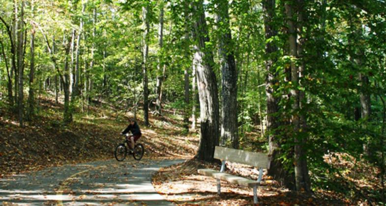
The Little Mulberry Park trail system has a variety of walking, biking, hiking, and equestrian trails. The park contains 5.5 miles of paved multi-purpose trails, including the Karina Miller Preserve Loop Trail, a National Recreation Trail. There are also 2.7 miles of hiking trails and 5 miles of equestrian trails. From the handicapped-accessible Pond Trail to the challenging unpaved Ravine Loop Trail, Little Mulberry Park offers walking, hiking, jogging, and biking opportunities for all ages and fitness levels.

Photo by David Firestine. Photo by Gwinnett County Parks and Recreation

Photo by David Firestine.

Photo by David Firestine.

Photo by David Firestine.

Photo by David Firestine.


Little Mulberry Park in Winter
Location: Little Mulberry Park, Gwinnett County, Georgia
- States: Georgia
- Counties: Gwinnett
- Cities/Townships: Auburn
Located in the northeast portion of Gwinnett County, the Little Mulberry Park trail system has a variety of walking, biking, hiking, and equestrian trails. The park contains 5.5 miles of paved multi-purpose trails, including the Karina Miller Preserve Loop Trail, a National Recreation Trail. There are also 2.7 miles of hiking trails and five miles of equestrian trails. From the handicapped-accessible Pond Trail to the challenging unpaved Ravine Loop Trail. All 13 miles of trails are situated within the scenic 890-acre park.
The Pond Trail is adjacent to the parking area at Fence Road and is a handicap-accessible 0.7-mile loop around a fishing pond. The trail is paved with asphalt and has a fishing pier. Beyond the large pavilion, restrooms and playground are the West Meadow and East Meadow Trails. Both are one-mile paved loops around a pair of grassy knolls. The terrain rises 126 feet from the Pond Trail near the parking lot to the top of the west meadow knoll. A short grass trail leads from the paved loop trail to the observation terrace at the top. At an elevation of 1206 feet above sea level, it is one of the highest points in Gwinnett County. The expansive views from the terrace provide opportunities for watching migrating raptors and astronomical observations. Several times a year, astronomy clubs hold night sky viewing events for the public.
The West Meadow Trail also provides access to the Ravine Loop Trail and the Beech Trail. These natural surface hiking trails total 2.6 miles in length and provide a strenuous hiking experience. Along the hiking trails park users will see dozens of stacked stone mounds. The mounds are typically about three feet in height and ten feet in diameter. Archaeological investigations have found that the mounds are attributed to pre-Colombian habitation by Native Americans and to post-settlement agriculture. The scenic ravine overlook is reached by a spur trail off the Ravine Loop Trail that leads to views of an intermittent waterfall.
The Carriage Trail was placed on the alignment of an old roadbed dating back more than 100 years. It is a very steep paved trail that is 0.7 miles long. Visitors will pass over a rustic stone box culvert and an intermittently flowing stream that spills over a series of exposed stone ledges. The Carriage Trail connects the meadow loop trails to the 2.2-mile Karina Miller Nature Preserve Loop, a National Recreation Trail.
The equestrian trail is accessed off Mineral Springs Road. The three to six feet wide trails wind through the hilly hardwood forests of the park.
In addition to the trails, the park has pavilions and shelters, restrooms, a disc golf course, playgrounds, a lake, and a fishing pond.
Accessibility Information
No text provided.
Allowed Uses:
Bicycling Dogs, on leash Equestrian Hiking/WalkingOther Activities
- Fishing
- Heritage and history
- Wildlife viewing / observation
Public Contact
Glenn BoormanGwinnett County Parks and Recreation
75 Langley Drive
Lawrenceville, GA
[email protected] • (770) 822-8873
Contact the trail manager for current maps and visiting details.
More Details
- Elevation (low): 1080
- Elevation (high): 1206
- Elevation (cumulative): --
- Part of a Trail System? No
- Surface (primary): Paved
- Surfaces (additional): Boardwalk, Soil
- Tread Width (average): 127"
- Tread Width (minimum): 48
- Running length (minimum): --
- Tread Grade (average, percent): 7
- Tread Grade (maximum): 25
- Running length (maximum): --
- Cross-slope (average, percent): 2
- Cross-slope (maximum): --
- Running length (maximum): --
- Certified as an NRT
Jun 2, 2014


