Little North Fork
This information is a public record of the 1984 NRT application and may be out of date if it has not been updated by a trail manager --
check with the trail manager for updated details before visiting.
check with the trail manager for updated details before visiting.
Little North Fork
USDA Forest Service
Backcountry Trail
- Length
0.25 miles
- Elevation Gain
--
- Route Type
out & back
- Length
0.25 miles - Elevation Gain
-- - Route Type
out & back
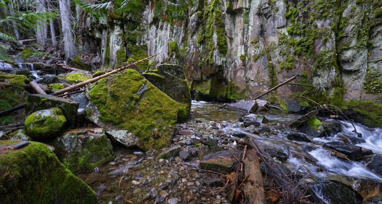
This trail provides easy access to a scenic fifty-foot water fall on the Little North Fork of Big Creek.
Location: 24 miles south west of Eureka
- States: Montana
- Counties: Lincoln
Little North Fork Falls is a very short trail that ends in a rain-forest type gorge. An easy to slightly moderate climb offers a view of the waterfall as it enters the gorge and drops into Little North Fork Creek. Some people have described their trip to the falls as being enveloped in time as it gives one the impression of time standing still.
Accessibility Information
No text provided.
Allowed Uses:
Dogs, on leash Hiking/WalkingOther Activities
- Wildlife viewing / observation
Public Contact
Eric HeynKootenai National Forest
1299 Hwy. 93 North
Eureka, MT 59917
[email protected] • (406) 296-2536
www.fs.usda.gov/kootenai
Contact the trail manager for current maps and visiting details.
More Details
- Elevation (low): 2760
- Elevation (high): 3000
- Elevation (cumulative): --
- Part of a Trail System? No
- National Designations: National Millennium
- State Designations: None/unknown
- Surface (primary): Rock, crushed
- Surfaces (additional): Rock, crushed
- Tread Width (average): 32"
- Tread Width (minimum): --
- Running length (minimum): --
- Tread Grade (average, percent): 4
- Tread Grade (maximum): 8
- Running length (maximum): --
- Cross-slope (average, percent): --
- Cross-slope (maximum): --
- Running length (maximum): --
- Certified as an NRT
Jul 4, 1984


