Lodgepole Ski Touring Trail
This information is a public record of the 1980 NRT application and may be out of date if it has not been updated by a trail manager --
check with the trail manager for updated details before visiting.
check with the trail manager for updated details before visiting.
Lodgepole Ski Touring Trail
USDA Forest Service
Backcountry Trail
- Length
3.5 miles
- Elevation Gain
--
- Route Type
out & back
- Length
3.5 miles - Elevation Gain
-- - Route Type
out & back
Location: 20 miles west of Anaconda, MT., Red Bridge Boat Launch,
- States: Montana
- Counties: Deer Lodge, Granite
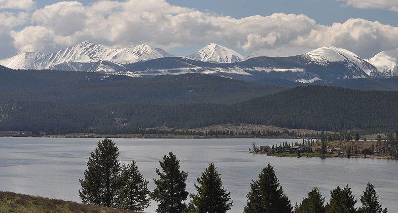
The trail traverses lodgepole pine forest with scattered openings affording scenic views of Georgetown Lake and the Anaconda Pintler Mountain Range.
Accessibility Information
No text provided.
Allowed Uses:
Snow, cross-country skiing Snow, snowshoeingOther Activities
- Snow, snow play general
Public Contact
Jennifer BlakeBeaverhead-Deerlodge National Forest
88 10-A Business Loop
Philipsburg, MT 59858
[email protected] • (406) 859-3211
www.fs.fed.us/r1/6-d
Contact the trail manager for current maps and visiting details.
More Details
- Elevation (low): 6400
- Elevation (high): 6907
- Elevation (cumulative): --
- Part of a Trail System? No
- Surface (primary): Snow or ice
- Surfaces (additional): Snow or ice
- Tread Width (average): 12"
- Tread Width (minimum): --
- Running length (minimum): --
- Tread Grade (average, percent): 8
- Tread Grade (maximum): 10
- Running length (maximum): --
- Cross-slope (average, percent): --
- Cross-slope (maximum): --
- Running length (maximum): --
- Certified as an NRT
May 31, 1980


