Long Trail
check with the trail manager for updated details before visiting.
Long Trail
USDA Forest Service
Backcountry Trail
- Length
54 miles
- Elevation Gain
--
- Route Type
out & back
(1 review)
- Length
54 miles - Elevation Gain
-- - Route Type
out & back
The entire trail runs from MA border to Canadian border through the Green Mountains. The NRT section is from Mt. Ellen to Killington Peak, SW of Montpelier.

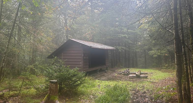
Shelter. Photo by Janie Walker

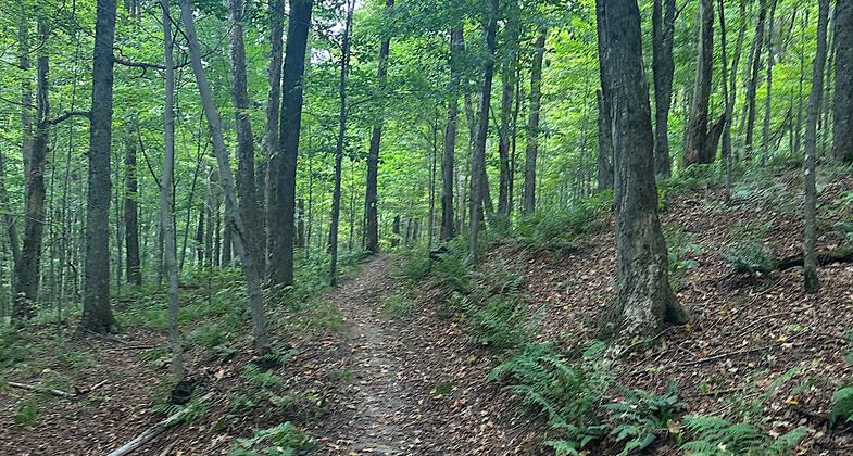
Trail

On Mt Abraham

The view of Mansfield's summit from the Long Trail. Photo by Calzarette/wiki.

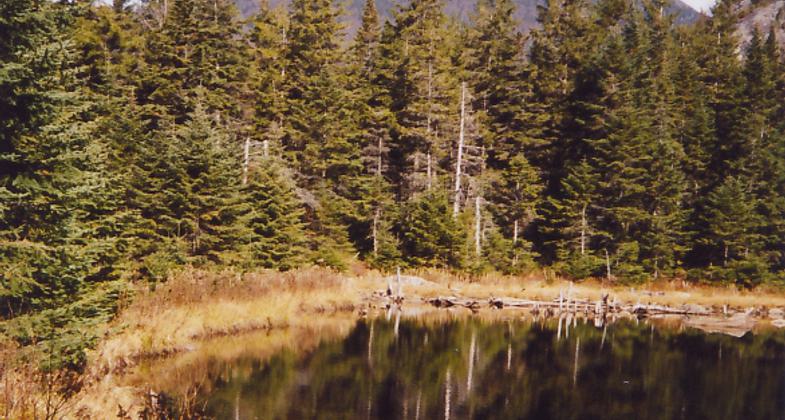
Little Rock Pond from the Long Trail. Photo by Omarcheeseboro/wiki.

View of Camels Hump from Long Trail. Photo by Broken Images/wiki.
Location: Green Mountain-Finger Lakes National Forest
- States: Vermont
- Counties: Rutland, Addison, Washington
Primitive footpath running through Green Mountain Forest, in varied natural and cultural conditions - wild, scenic, wooded, pastoral. Favors the heights of land.
Accessibility Information
No text provided.
Reviews
Janie Walker
Hike the whole thing if you can
The Long Trail is the oldest long-distance hiking trail in the USA and was the inspiration for the Appalachian Trail. This is a backcountry trail within Vermont’s wilderness. I had hoped to backpack the whole thing this month, but my elderly cat is not long for this world so I decided to just day hike the NRT portion in five sections so as not to be gone too long or too often for my feline. I have hiked other, more northern parts of the Long Trail during previous adventures. The NRT section is a green tunnel with relatively few viewpoints compared with the Long Trail north of Appalachian Gap. Except for a small scramble up Mt Abraham, the terrain is fairly straightforward. Lots of shelters along the way with privies and tenting spots. Reliable streams throughout. The FarOut app (formerly Guthooks) is helpful. I am giving the trail five stars, though I am curious as to why the NRT section does not incorporate miles farther north which would give the hiker more spectacular and consistent views along with more scrambles and interesting terrain. Sept 2023
Allowed Uses:
Hiking/Walking Snow, cross-country skiing Snow, snowshoeingOther Activities
- Camping
- Fishing
- Snow, snow play general
- Wildlife viewing / observation
Public Contact
Green Mountain-Finger Lakes National Forest231 N. Main
Rutland, VT 5701
(802) 747-6700
www.fs.usda.gov/main/gmfl/home
More Details
- Elevation (low): 1800
- Elevation (high): 4083
- Elevation (cumulative): --
- Part of a Trail System? No
- Surface (primary): Soil
- Surfaces (additional): --
- Tread Width (average): 18"
- Tread Width (minimum): --
- Running length (minimum): --
- Tread Grade (average, percent): 15
- Tread Grade (maximum): 30
- Running length (maximum): --
- Cross-slope (average, percent): --
- Cross-slope (maximum): --
- Running length (maximum): --
- Certified as an NRT
Oct 14, 1986


