Lost Cabin Lake
This information is a public record of the 1979 NRT application and may be out of date if it has not been updated by a trail manager --
check with the trail manager for updated details before visiting.
check with the trail manager for updated details before visiting.
Lost Cabin Lake
USDA Forest Service
Backcountry Trail
- Length
4 miles
- Elevation Gain
--
- Route Type
out & back
- Length
4 miles - Elevation Gain
-- - Route Type
out & back
Location: In Deerlodge National Forest, from Cardwell take SR 359 5 mi. to S. Boulder Road, the S 15 mi. to Bismark Reservoir.
- States: Montana
- Counties: Madison
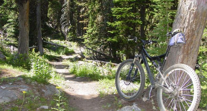
The Lost Cabin Lake Trail begins at the west end of Bismark Reservoir. The peaks surrounding the lake reach elevations above 10,000 feet. Mountain goats can often be seen on the cliffs to the south and east of the lake. Depending on snow, the trail is usually open from July 1 to the middle of October. Snowdrifts on the trail may be abundant during years of late thaws.
Accessibility Information
No text provided.
Allowed Uses:
Bicycling Dogs, on leash Equestrian Hiking/Walking Snow, cross-country skiingOther Activities
- Camping
- Fishing
- Snow, snow play general
Public Contact
Eric TolfBeaverhead-Deerlodge National Forest
3 White Tail Rd.
Custer, SD 57730
[email protected] • (406) 287-3223
www.fs.usda.gov/bdnf
Contact the trail manager for current maps and visiting details.
More Details
- Elevation (low): 7360
- Elevation (high): 9060
- Elevation (cumulative): --
- Part of a Trail System? No
- Surface (primary): Soil
- Surfaces (additional): Soil
- Tread Width (average): 24"
- Tread Width (minimum): --
- Running length (minimum): --
- Tread Grade (average, percent): 8
- Tread Grade (maximum): 15
- Running length (maximum): --
- Cross-slope (average, percent): --
- Cross-slope (maximum): --
- Running length (maximum): --
- Certified as an NRT
Dec 12, 1979


