Lost Coast Trail
check with the trail manager for updated details before visiting.
Lost Coast Trail
Bureau of Land Management
Backcountry Trail
- Length
24.8 miles
- Elevation Gain
--
- Route Type
out & back
- Length
24.8 miles - Elevation Gain
-- - Route Type
out & back
The Lost Coast Trail offers one of the few coastal wilderness hiking experiences in the United States.


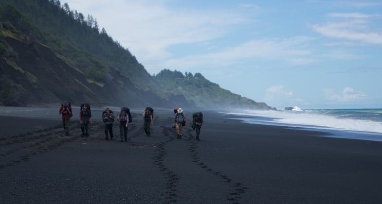
Trekkers framed by the beach cliffs and tide. Photo by Spencer Cross.

The warm light of a campfire illuminates the surrounding trees. Photo by Spencer Cross.

The brilliant yellow of the Rattle Snake Grass leads the viewer down a dirt fire road. Photo by Spencer Cross.

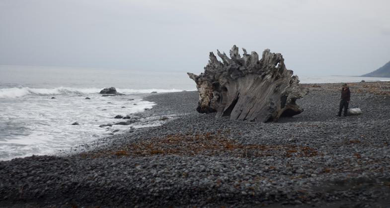
A giant tree trunk towers over a person. Photo by Spencer Cross.

Posing crab. Photo by Spencer Cross.

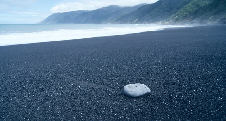
Line in the sand. Photo by Spencer Cross.
Location: Access at King Range Nat. Conservation Area trailheads.
- States: California
- Counties: Humboldt
The trail is 24.8 miles, mostly level. Hikers can view sea lions, tidepools, and spectacular spring wildflowers. Solitude can be difficult to find on holiday weekends, so try to plan your hike during weekdays, or the less crowded spring/fall months. Never turn your back on the ocean; large sleeper waves can occur at any time, sweeping unsuspecting hikers into the ocean.
Allow at least three days for the entire hike. Much of the trail is beach hiking with several stretches of 1-2 ft. rounded boulders. Stream crossings may be impassable during/after heavy winter rains (no bridges). The area near Punta Gorda from Sea Lion Gulch to Randall Creek; and from Miller Flat to Gitchell Creek may be impassable during high tide. Carry a tide table, and when in doubt, hike these stretches during an outgoing tide to avoid being trapped.
Permits are required for overnight use in the King Range Wilderness. Visitors can book their permit reservations at www.recreation.gov. Permits are not required for day use or in designated campgrounds. King Range Wilderness Permits for 2018 are available and the max permit size is reduced from 15 people to 5. The max group size will remain at 15, so a max group of 15 people would need to reserve three permits.
An additional Special Recreation Permit is required for commercial and organized groups. Examples of organized groups are scout troops, social media groups, schools, and universities. Permits must be submitted at least 30 days before your trip. The minimum fee for any commercial or organized group is $110, plus any fees due in excess of the minimum fee. Please contact the King Range Project Office to request a Special Recreation Permit application.
No Special Recreation Permits for commercial or organized groups will be issued for Memorial Day, Independence Day, or Labor Day weekends. Although overnight camping permits are available year-round, weekends (especially holiday weekends) are busy times to visit the area. Please check availability for opportunities to visit this summer. Visitors are also encouraged to day hike, which does not require a permit.
Accessibility Information
No text provided.
Allowed Uses:
Hiking/WalkingPublic Contact
King Range Conservation Area768 Shelter Cove Road
Whitethorn, CA 95589
(707) 986-5400
Contact the trail manager for current maps and visiting details.
More Details
- Elevation (low): --
- Elevation (high): --
- Elevation (cumulative): --
- Part of a Trail System? No
- Surface (primary): --
- Surfaces (additional): --
- Tread Width (average): 0"
- Tread Width (minimum): --
- Running length (minimum): --
- Tread Grade (average, percent): --
- Tread Grade (maximum):
- Running length (maximum): --
- Cross-slope (average, percent): --
- Cross-slope (maximum): --
- Running length (maximum): --
- Certified as an NRT
Sep 12, 1995

