Lower Macleay Trail
check with the trail manager for updated details before visiting.
Lower Macleay Trail
City, Town, or County
Backcountry Trail
Urban Trail
- Length
0.86 miles
- Elevation Gain
--
- Route Type
out & back
- Length
0.86 miles - Elevation Gain
-- - Route Type
out & back
The Lower Macleay Trail is an oasis in the city. The trail follows Balch Creek along the floor of Balch Canyon. The creek is one of the few remaining perennial creeks in the City that support a healthy aquatic habitat.

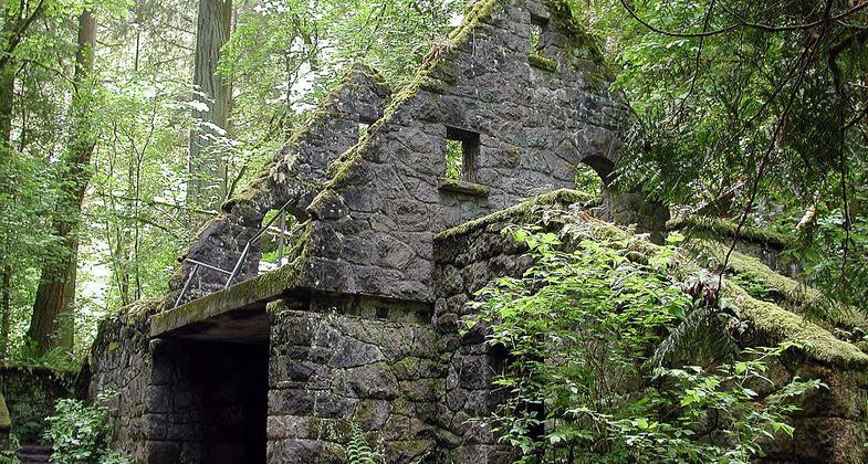
Stone structure in Macleay Park. Photo by Finetooth wiki.

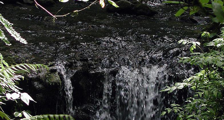
Waterfall on Balch Creek in Macleay Park. Photo by Finetooth wiki.
Location: Forest Park, National Portland
- States: Oregon
- Counties: Multnomah
The Lower Macleay Trail is an oasis in the city. The trail follows Balch Creek along the floor of Balch Canyon. The creek is one of the few remaining perennial creeks in the City that support a healthy aquatic habitat. Balch Creek is home to a population of native cutthroat trout. The trail is located in Forest Park, which is the largest forested urban park in the nation. Due to its close proximity to a densely populated area, the trail is a major access route into the Park and its 80-mile trail system. The trail is one of, if not the most used trail in the Park. The first 300 yards of the trail is handicapped accessible and ends with an overlook above the creek. The other end of the .86-mile trail connects with the Wildwood Trail, which was granted NRT designation in 1974. At the junction stands a 1930s WPA project commonly called the Stone House. Though now dilapidated, the building once served as a visitors center but now best serves as fodder for local legends. Though the trail is less than a mile it traverses a full Northwestern conifer temperate rainforest. Mature western red cedar, western hemlock, big-leaf maple, vine maple, red alder, and especially Douglas fir thrive in the cool, moist canyon. Standing at 241', one of the Douglas firs is the tallest urban tree in the nation. All of this is less than two miles from downtown Portland. The trail's proximity gives all of the city:s population an easily accessible escape from the city into a remarkable forest.
Accessibility Information
No text provided.
Allowed Uses:
Hiking/WalkingPublic Contact
Ms. Gregg EverhartCity of Portland, Parks & Recreation
Planing , Portland P&R
Portland, OR 97221
[email protected] • (503) 823-6009
www.parks.ci.portland.or.us/Default.htm
Contact the trail manager for current maps and visiting details.
More Details
- Elevation (low): 100
- Elevation (high): 450
- Elevation (cumulative): --
- Part of a Trail System? No
- Surface (primary): Soil
- Surfaces (additional): --
- Tread Width (average): 36"
- Tread Width (minimum): --
- Running length (minimum): --
- Tread Grade (average, percent): 10
- Tread Grade (maximum): 16
- Running length (maximum): --
- Cross-slope (average, percent): --
- Cross-slope (maximum): --
- Running length (maximum): --
- Certified as an NRT
Jun 1, 2004


