Mackinac Island Trail System
check with the trail manager for updated details before visiting.
Mackinac Island Trail System
State
Rail Trail
- Length
15 miles
- Elevation Gain
--
- Route Type
out & back
- Length
15 miles - Elevation Gain
-- - Route Type
out & back
Trail system in Michigan's first state park.

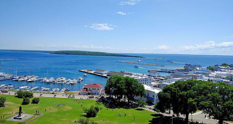
Mackinac Island view from Fort Mackinac. Photo by Viplav Valluri wiki.

Devils Kitchen on Mackinac Island. Photo by Notorious4life wiki.

Skull Cave on Mackinac Island. Photo by Notorious4life (talk) wiki.

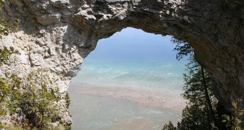
Arch Rock on Mackinac Island. Photo by Jeffness wiki.
Location: At Mackinac Island State Park E of Mackinac Bridge.
- States: Michigan
Mackinac Island State Park was established in 1895. For twenty years before that, it had been Mackinac National Park, the United States' second national park. Today, over eighty percent of Mackinac Island is State Park property, and most of this park land remains in its natural condition to be enjoyed.
The park is filled with historic attractions. Fort Mackinac and the Historic Downtown sites are the most prominent, but there are many points of interest and monuments throughout the park.
Mackinac Island State Park contains 70.5 miles of signed and interpreted roads and trails. Some are paved, and some are not. Some are shared by horses, bikes, and walkers; others are best for hiking only. There are also over 50 interpretive panels throughout the park that describe the natural wonders and historic locations.
Accessibility Information
No text provided.
Allowed Uses:
Bicycling Hiking/WalkingPublic Contact
Michigan Dept. of Natural ResourcesP.O. Box 30028
Lansing, MI 48909
Contact the trail manager for current maps and visiting details.
More Details
- Elevation (low): --
- Elevation (high): --
- Elevation (cumulative): --
- Part of a Trail System? No
- Surface (primary): --
- Surfaces (additional): --
- Tread Width (average): 0"
- Tread Width (minimum): --
- Running length (minimum): --
- Tread Grade (average, percent): --
- Tread Grade (maximum):
- Running length (maximum): --
- Cross-slope (average, percent): --
- Cross-slope (maximum): --
- Running length (maximum): --
- Certified as an NRT
Sep 7, 1980


