Mad Creek Greenbelt
This information is a public record of the 1980 NRT application and may be out of date if it has not been updated by a trail manager --
check with the trail manager for updated details before visiting.
check with the trail manager for updated details before visiting.
Mad Creek Greenbelt
City, Town, or County
Frontcountry Trail
- Length
1.2 miles
- Elevation Gain
--
- Route Type
out & back
- Length
1.2 miles - Elevation Gain
-- - Route Type
out & back
The Mad Creek Greenbelt trail is just over one mile long and connects Park Avenue West to Lake Park Blvd. The trail runs along Mad creek and passes underneath the U.S. 61 Bypass in Muscatine.

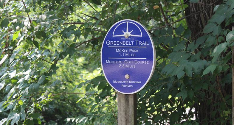
Welcome sign on the Greenbelt. Photo by Kevin Jenison.

Trail photo. Photo by Kevin Jenison.
Location: In Muscatine on Lake Park Blvd and Old Hwy. 38.
- States: Iowa
- Counties: Muscatine
This 1.2-mile trail is a portion of a larger 8-mile Greenbelt river trail system in the area. The Mad Creek portion begins at Park Avenue West and will transport you to Lake Park Boulevard. Jump on this trail at multiple locations. McKee Park is your trailhead entrance to the north and Oak Park is where you will pick up the trail on the south side.
Accessibility Information
No text provided.
Allowed Uses:
Bicycling Hiking/WalkingPublic Contact
Muscatine Parks and Rec. Dept.City Hall
Muscatine, IA 52761
Contact the trail manager for current maps and visiting details.
More Details
- Elevation (low): --
- Elevation (high): --
- Elevation (cumulative): --
- Part of a Trail System? No
- Surface (primary): --
- Surfaces (additional): --
- Tread Width (average): 0"
- Tread Width (minimum): --
- Running length (minimum): --
- Tread Grade (average, percent): --
- Tread Grade (maximum):
- Running length (maximum): --
- Cross-slope (average, percent): --
- Cross-slope (maximum): --
- Running length (maximum): --
- Certified as an NRT
Oct 8, 1980

