Magnolia Trail
check with the trail manager for updated details before visiting.
Magnolia Trail
U.S. Fish and Wildlife Service
Backcountry Trail
- Length
4.5 miles
- Elevation Gain
--
- Route Type
out & back
(1 review)
- Length
4.5 miles - Elevation Gain
-- - Route Type
out & back
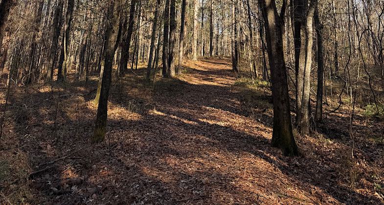
Three-mile walking trail through loess bluffs that rise above the Homochitto River. The Magnolia Trail traverses various wildlife habitats and topographic features including loess bluffs that rise above the Homochitto River. Visitors who choose the low-lying area of the trail can expect to see numerous mammals, migratory songbirds, and waterfowl. Those who venture on the bluffs can often catch a glimpse of the Mississippi River during flood conditions.

Photo by Trish Ellis. Photo by Trish Ellis

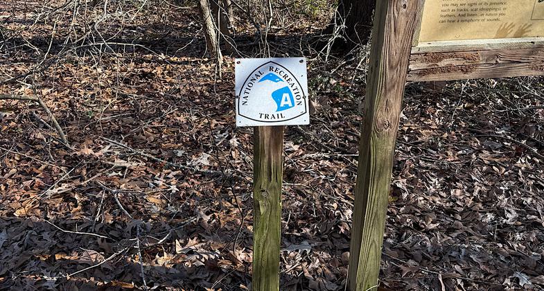
NRT sign

Magnolia Trail at St. Catherine Creek Refuge
Location: St. Catherine Creek National Wildlife Refuge, Sibley MS
- States: Mississippi
- Counties: Adams
Three-mile walking trail through loess bluffs that rise above the Homochitto River. The Magnolia Trail traverses various wildlife habitats and topographic features including loess bluffs that rise above the Homochitto River. Visitors who choose the low-lying area of the trail can expect to see numerous mammals, migratory songbirds, and waterfowl. Those who venture on the bluffs can often catch a glimpse of the Mississippi River during flood conditions.
The Magnolia Trail accesses a bird rookery with views of herons, egrets, waterfowl, and alligators from a new photography and wildlife observation blind, funded by the Friends of St. Catherine Creek Refuge, the supporting association for St. Catherine NWR. Another popular stop along the trail is the Cypress Knee Overlook which provides the opportunity for diverse wildlife observations, especially during flood conditions.
Just south of Natchez, Mississippi, the Refuge and Magnolia Trail serve a broad and diverse population in the southeastern Louisiana-southwestern Mississippi area. Birding and school groups throughout the area use the trail for field trips. Interpretive signs along the trail are used by individuals and families and as educational tools by the many school groups visiting the refuge. Benches have also been placed along the trail for resting areas, spots for picnic lunches, opportunities for photography, wildlife observation, and scenic views.
The Magnolia Trail is truly a community project. Besides its use by the public, it is maintained in excellent condition by the Friends of St. Catherine Creek Refuge, local scout groups, other community service organizations, and the refuge staff. According to Jack Cupit, "Trails such as this not only provide a good source of exercise but are a true learning experience each time it is walked. We feel this trail is an important attribute to our community due in part to the fact that it serves as a living classroom for our school children. Children are the future of our country and we feel it is important to inform and educate them about our natural resources and the conservation of habitat and wildlife."
Two new features along the trail include:
1. Kids Fishing Pond and Pier - The trail now takes visitors around our new Kid's Only Fishing Pond, which is wheelchair-accessible. Visitors are also encouraged to walk along the pier not only for fishing but to view the abundant species of aquatic wildlife.
2. Animal Olympics - Signs have been installed along the trail that allows visitors of all ages to participate in activities that mimic various animals. Those who are interested may take along an Olympic Game Sheet where they keep track of their activities. Upon their return to the headquarters, a completion certificate will be awarded to the participants of the game.
Accessibility Information
No text provided.
Reviews
Patricia Ellis
Needs some maintenance, but still enjoyable
Magnolia Trail was once well maintained, you can tell by the wide path, the rope handrails, and a pond viewing platform that is now falling apart. The NRT sign is faded and not at the current trailhead. There is currently one small section of trail that is badly eroded and needs rerouting. It is still a nice walk in the woods, but the trail needs a bit of maintenance. Hiked January 11, 2025. Trish Ellis (aka Janie Walker)
Allowed Uses:
Dogs, on leash Hiking/WalkingOther Activities
- Wildlife viewing / observation
Public Contact
Bob StraderUSFWS
PO Box 217
Sibley, MS 39165
[email protected] • (601) 442-6696
aintcatherinecreek.fws.gov
Contact the trail manager for current maps and visiting details.
More Details
- Elevation (low): 50
- Elevation (high): 75
- Elevation (cumulative): --
- Part of a Trail System? No
- National Designations: None/unknown
- State Designations: None/unknown
- Surface (primary): Rock, crushed
- Surfaces (additional): Rock, crushed
- Tread Width (average): 60"
- Tread Width (minimum): --
- Running length (minimum): --
- Tread Grade (average, percent): 5
- Tread Grade (maximum): 30
- Running length (maximum): --
- Cross-slope (average, percent): --
- Cross-slope (maximum): --
- Running length (maximum): --
- Certified as an NRT
Jun 3, 2005


