Marble Creek Trail System
This information is a public record of the 1984 NRT application and may be out of date if it has not been updated by a trail manager --
check with the trail manager for updated details before visiting.
check with the trail manager for updated details before visiting.
Marble Creek Trail System
USDA Forest Service
Backcountry Trail
- Length
26.7 miles
- Elevation Gain
--
- Route Type
out & back
- Length
26.7 miles - Elevation Gain
-- - Route Type
out & back

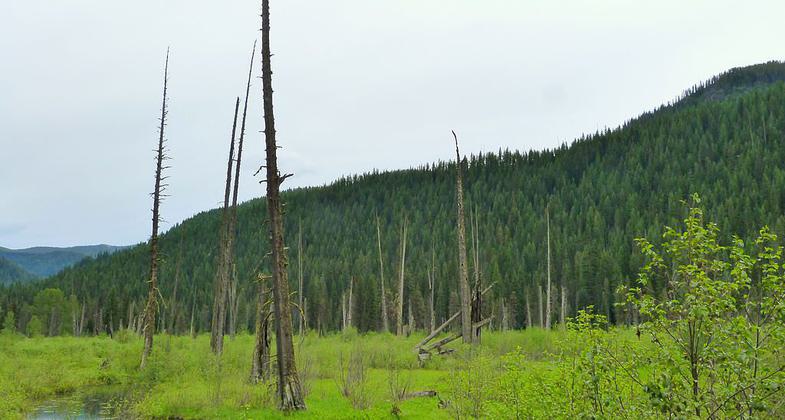
Cedar Snags in St. Joe National Forest. Photo by Ian Poellet wiki.

St. Joe River. Photo by Ian Poellet wiki.

St. Joe National Forest. Photo by Ian Poellet wiki.
Location: Marble Creek, ID; Panhandle National Forest
- States: Idaho
- Counties: Shoshone
Trail #261 is part of the Marble Creek trail system and features fishing opportunities in Marble Creek, remnants of cabins, historical logging sites, and good huckleberry picking when they are in season. Open to motorbikes but recommended for advanced riders.
Accessibility Information
No text provided.
Allowed Uses:
Dogs, on leash Equestrian Hiking/Walking Motorized vehicles, motorcycling Snow, snowshoeingOther Activities
- Camping
- Snow, snow play general
- Wildlife viewing / observation
Public Contact
Tracy GravellePanhandle National Forest
HC Box 1
Avery, ID 83802
(208) 245-4517
Contact the trail manager for current maps and visiting details.
More Details
- Elevation (low): --
- Elevation (high): --
- Elevation (cumulative): --
- Part of a Trail System? No
- Surface (primary): Soil
- Surfaces (additional): Soil
- Tread Width (average): 18"
- Tread Width (minimum): --
- Running length (minimum): --
- Tread Grade (average, percent): 5
- Tread Grade (maximum): 15
- Running length (maximum): --
- Cross-slope (average, percent): --
- Cross-slope (maximum): --
- Running length (maximum): --
- Certified as an NRT
Apr 4, 1984


