Martin Van Buren Nature Trails
check with the trail manager for updated details before visiting.
Martin Van Buren Nature Trails
Nonprofit
Backcountry Trail
- Length
3.7 miles
- Elevation Gain
--
- Route Type
Loop
- Length
3.7 miles - Elevation Gain
-- - Route Type
Loop
The Martin Van Buren Nature Trail comprises 70 acres of land across from the Martin Van Buren Natural Historic Site. The four trails that cut through the park are organized by a color coded trail system and total 3.7 miles in length. Trails lead to a meadow, a stream and a marsh and exhibit various species of trees, shrubs, flowers and wildlife. The trail has gentle slopes for easy walking/hiking.

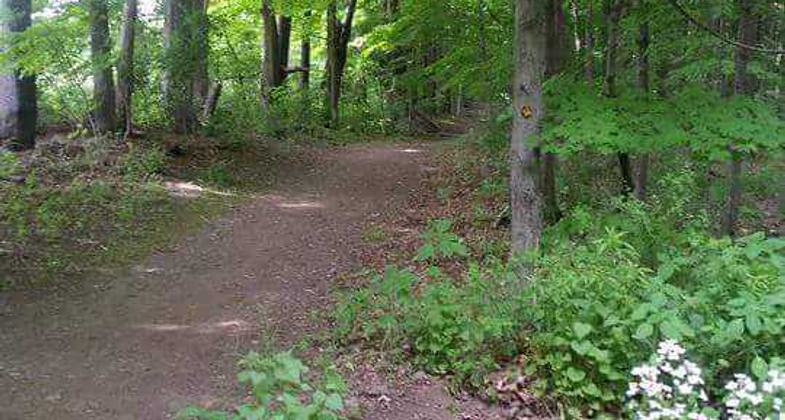
trail marker at MVB trail. Photo by Ann Scharoun

main trail

trail with culvert to be repaired

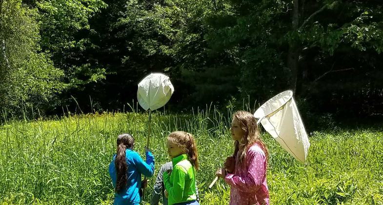
Educ program - students using nets to capture bugs in meadow

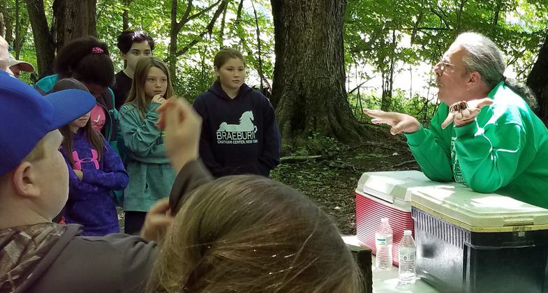
educ program
Location: 2408 State Route 9H, Kinderhook, NY (Across from the Martin Van Buren National Historic Site)
- States: New York
- Counties: Columbia
- Cities/Townships: Kinderhook
The Martin Van Buren (MVB) Nature Trail comprises 70 acres across from the Martin Van Buren National Historic Site and is home of our nation's 8th president, Lindenwald. Visitors to Lindenwald can enhance their visit by walking the trail and witnessing an environment similar to what the former President would have enjoyed in his retirement. The MVB Trail is owned by the Friends of Lindenwald, a non-profit 501(c) (3) organization incorporated by the New York State Education Department as an educational organization.
The four trails that cut through the park are organized by a color-coded trail system. The start and backbone of the trail served as a path and right of way for over 100 years and is bordered by old maples, ash, and oak trees. Trails break off from the old pathway and provide a loop back to the main path. The four trails total 3.7 miles in length.
The Trail is part of the Dutch Farming Heritage Trail which was a project of the Columbia County Historical Society, the National Park Service, the Friends of Lindenwald, and the Albany Hudson Electric Trail group from Kinderhook. The Dutch Farming Heritage Trail connects the historic Van Alen house (Dutch farmhouse built in 1727) and the Ichabod Crane Schoolhouse (mid-19th century schoolhouse) through areas of Roxbury Farm (an organic farm whose owner has a special relationship with the NPS to use his land for interpretation of farming methods), down a historic portion of Old Post Road, and to the parking lot of the Martin Van Buren National Historic Site. Hikers can enjoy forest, farm, and stream views while hiking along rolling hills.
The MVB Trail is an ideal location for hiking and walking and is a favorite site for families and dog walkers. The Trail is also used by local Cub Scout Pack 117 (Niverville) for day hikes and Boy Scout troops 114 (Valatie) and 13 (Kinderhook) for camping and working toward merit badges. Scouts from Troop 114 have done several Eagle Projects at the site, including digging a spring for wildlife use, constructing an outhouse, and construction of several benches along the trail for hikers. The Scouts have also done several community service projects on the property including the removal of dead trees and trees across the trails, remarking trails, and clearing the field areas. The Friends of Lindenwald are working with Troop #114 to build a permanent campfire pit.
The MVB Trail is also used for environmental education. For the last three years, the Friends of Lindenwald has sponsored an Environmental Awareness Day for 6th graders in June. The program begins at Lindenwald with a talk about Van Buren's farm and the agricultural methods he used. The group moves to the MVB Nature Trail where the Columbia Greene County Cooperative Extension and other local environmental educators interpret different environmental issues for the students at 4 -6 stations. Students rotate through 20-minute sessions throughout the Park. Currently two schools, (Ichabod Crane and Chatham Central) participate and more schools are expected to participate next year.
In the 1970s Columbia County owned the 70-acre site and proposed putting a landfill there. At the same time, local groups were negotiating with the National Park Service about acquiring the 8th President's home as a National Historic site. With the acceptance of the federal designation and strong opposition from the community and local elected officials, the County reversed its decision in the early 1980s and approached Cornell Cooperative extension about finding a 4H club to turn the site into a nature trail. In 1991, the Friends of Lindenwald took over the management and maintenance of the trails. Acquisition of the trails from the County was attempted in 1991 but was only accomplished in 2013.
Once the Friends of Lindenwald took possession of the property it prepared a budget and hired a Natural Resource Consultant to write a trail management plan. In June of 2017, the Trail received New York State Greenway status and in August the first of a 3-phase management plan was completed. Over time and with active use and flow of a seasonally vigorous stream, the trail system has been impacted by sheet and rill (washout) erosion. Implementation of the management plan to reduce this erosion as well as a reduction of trail hazards (tree roots, dead trees over the pathways) will increase the quality of the recreational experience. The removal of dangerous dead trees was recently completed in October 2017.
To minimize trail erosion and make the trail more accessible, the plan calls for the construction of bog bridges which will reduce the instances of patron-exacerbated erosion by 80% in the first year. Implementing location-specific erosion control methods (e.g. improving and building new culverts) will lead to a 50% reduction in instances of sheet and rill erosion.
Accessibility Information
No text provided.
Allowed Uses:
Dogs, off leash Dogs, on leash Hiking/Walking Snow, cross-country skiing Snow, snowshoeingOther Activities
- Camping
- Heritage and history
- Snow, snow play general
- Wildlife viewing / observation
Public Contact
Richard AndersonFriends of Lindenwald
2397 County Route 21
Valatie, NY 12184
[email protected] • 518-758-6433
Contact the trail manager for current maps and visiting details.
More Details
- Elevation (low): 220
- Elevation (high): 350
- Elevation (cumulative): --
- Part of a Trail System? No
- State Designations: NYS Greenway
- Surface (primary): Soil
- Surfaces (additional): Soil
- Tread Width (average): 60"
- Tread Width (minimum): 24
- Running length (minimum): --
- Tread Grade (average, percent): 1
- Tread Grade (maximum): 5
- Running length (maximum): --
- Cross-slope (average, percent): 2
- Cross-slope (maximum): --
- Running length (maximum): --
- Certified as an NRT
May 16, 2018


