Mary Ingles Trail System
This information is a public record of the 2001 NRT application and may be out of date if it has not been updated by a trail manager --
check with the trail manager for updated details before visiting.
check with the trail manager for updated details before visiting.
Mary Ingles Trail System
State
Backcountry Trail
- Length
3.5 miles
- Elevation Gain
--
- Route Type
out & back
- Length
3.5 miles - Elevation Gain
-- - Route Type
out & back
Location: Yatesville Lake State Park, Louisa, KY
- States: Kentucky
- Counties: Lawrence
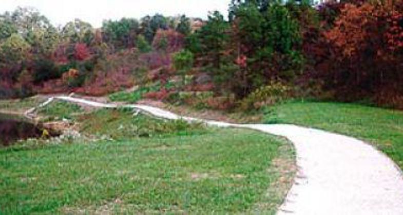
The trail is located in the Yatesville Lake State Park, 40 miles south of Ashland, Kentucky. This trail system is comprised of six unique and varied trail loops. There are two paved exercise paths, one nature trail with access for the disabled, and three rugged primitive nature trails. The total length is eight miles, of which 3.5 miles of the trail is fully accessible. The Mary Ingles Trail System offers many scenic views of Yatesville Lake.
Accessibility Information
No text provided.
Allowed Uses:
Bicycling Swimming Dogs, on leash Hiking/WalkingOther Activities
- Fishing
- Wildlife viewing / observation
Public Contact
Mike SullivanKentucky State Parks
Yatesville Division
Louisa, KY 41230
[email protected] • (606) 673-1492
Contact the trail manager for current maps and visiting details.
More Details
- Elevation (low): --
- Elevation (high): --
- Elevation (cumulative): --
- Part of a Trail System? No
- National Designations: Community Millennium
- Surface (primary): --
- Surfaces (additional): --
- Tread Width (average): 48"
- Tread Width (minimum): --
- Running length (minimum): --
- Tread Grade (average, percent): --
- Tread Grade (maximum):
- Running length (maximum): --
- Cross-slope (average, percent): --
- Cross-slope (maximum): --
- Running length (maximum): --
- Certified as an NRT
May 31, 2001


