Mass Central Rail Trail (Northampton Section)
check with the trail manager for updated details before visiting.
Mass Central Rail Trail (Northampton Section)
City, Town, or County
Frontcountry Trail
Rail Trail
Urban Trail
- Length
5.3 miles
- Elevation Gain
--
- Route Type
out & back
(1 review)
- Length
5.3 miles - Elevation Gain
-- - Route Type
out & back
5.3-mile trail running from the northern terminus of New Haven & Northampton Canal Rail trail on the northerly side of Northampton and easterly terminus of state-owned MassCentral Rail Trail to South Main Street, Williamsburg.
Location: Located in Northampton, Mass, extending from the northern terminus of the New Haven & Northampton Canal Rail Trail on the north side of downtown Northampton and extending northwesterly through Northampton and to South Main Street in Williamsburg.
- States: Massachusetts
- Counties: Hampshire
- Cities/Townships: Northampton and Williamsburg
5.3-mile trail running from the northern terminus of New Haven & Northampton Canal Rail trail and easterly terminus of state-owned Mass Central Rail Trail to South Main Street, Williamsburg. Easily accessible to 50% of the population of Northampton and runs through the edge of downtown Northampton and through the villages of Florence and Leeds. The trail includes two dramatic historic stone arch bridges, with the northerly mile adjacent to and overlooking the Mill River. Portions of the trail were among the first municipal rail trails developed in New England (1985), with the trail expanded in 2011 to connect to other rail trails and tie various village centers together. Highlights along the trail include downtown Northampton, Barrett Street Marsh, downtown Florence, Look Park, the Village of Leeds, and the Mill River.
Accessibility Information
No text provided.
Reviews
Janie Walker
Neighborhood bike path
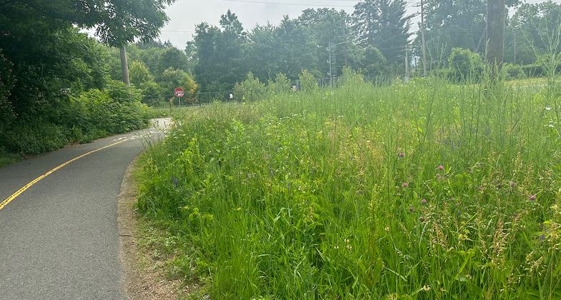
Bike path connecting local neighborhoods and shopping centers. Heavily used by pedestrians and bicyclists. I give it five stars because it serves its purpose and is what it says it is. No stellar views, just a treed bike path connecting neighborhoods.
Allowed Uses:
Bicycling Dogs, on leash Hiking/Walking Snow, cross-country skiingOther Activities
- Fishing
- Snow, snow play general
Public Contact
Ned HuntleyCity of Northampton
125 Locust Street
Northampton, MA 01060
413-587-1570
Contact the trail manager for current maps and visiting details.
More Details
- Elevation (low): 118
- Elevation (high): 130
- Elevation (cumulative): --
- Part of a Trail System? No
- Surface (primary): Paved
- Surfaces (additional): Paved, Rock, crushed
- Tread Width (average): 120"
- Tread Width (minimum): 120
- Running length (minimum): --
- Tread Grade (average, percent): 1
- Tread Grade (maximum): 8
- Running length (maximum): --
- Cross-slope (average, percent): 0
- Cross-slope (maximum): --
- Running length (maximum): --
- Certified as an NRT
Jun 2, 2014


