McGowan National Recreation Trail
This information is a public record of the 1981 NRT application and may be out of date if it has not been updated by a trail manager --
check with the trail manager for updated details before visiting.
check with the trail manager for updated details before visiting.
McGowan National Recreation Trail
USDA Forest Service
Backcountry Trail
- Length
10 miles
- Elevation Gain
--
- Route Type
out & back
- Length
10 miles - Elevation Gain
-- - Route Type
out & back
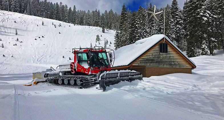
The McGowan Lake Cross-Country Ski Area has been in existence since 1982 and offers 10 miles of trails, 5 miles of which are periodically groomed
Location: In Lassen NF 6 mi. E of Mineral on Forest Rds. 29N22 and 30N16.
- States: California
- Counties: Tehama
Access is on Highway 89, 2 miles north of Highway 36 and near the southern entrance to Lassen Volcanic National Park. Literally in the shadow of Lassen Peak, McGowan area trails wander through mixed conifer forest and are popular with beginning to advanced skiers. Elevations range from 5,020 to 6,200 feet. McGowan cross-country ski trails are closed to all motorized vehicles.
Accessibility Information
No text provided.
Allowed Uses:
Hiking/Walking Snow, cross-country skiing Snow, snowshoeingOther Activities
- Snow, snow play general
Public Contact
Michelle AhearnUS Forest Service
Lassen National Forest
Chester, CA 96020
[email protected] • (530) 258-2141
Contact the trail manager for current maps and visiting details.
More Details
- Elevation (low): 5020
- Elevation (high): 6200
- Elevation (cumulative): --
- Part of a Trail System? No
- Surface (primary): Snow or ice
- Surfaces (additional): --
- Tread Width (average): 0"
- Tread Width (minimum): --
- Running length (minimum): --
- Tread Grade (average, percent): 3
- Tread Grade (maximum): 4
- Running length (maximum): --
- Cross-slope (average, percent): --
- Cross-slope (maximum): --
- Running length (maximum): --
- Certified as an NRT
Oct 10, 1981


