Meadowlark Trail
check with the trail manager for updated details before visiting.
Meadowlark Trail
U.S. Fish and Wildlife Service
Backcountry Trail
Urban Trail
- Length
6 miles
- Elevation Gain
--
- Route Type
out & back
- Length
6 miles - Elevation Gain
-- - Route Type
out & back
Located in Boyer Chute National Wildlife Refuge, this 6-mile rural loop trail system accesses a variety of natural settings, including woodland, restored native prairie, and riparian habitats.

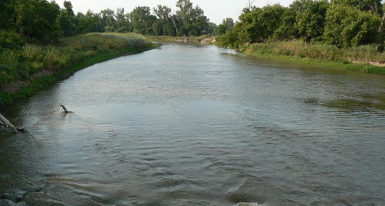
Boyer Chute River Looking North. Photo by MONGO wiki.

Sand Dunes along County Road 34 in Boyer Chute Refuge. Photo by MONGO wiki.

Boyer Chute Wildlife Refuge Information Sign. Photo by MONGO wiki.

Boyer Chute River. Photo by MONGO wiki.
Location: Boyer Chute National Wildlife Refuge, Ft. Calhoun NE
- States: Nebraska
- Counties: Washington
Located in Boyer Chute National Wildlife Refuge, this 6-mile rural loop trail system accesses a variety of natural settings, including woodland, restored native prairie, and riparian habitats.
The Meadowlark (grassland) trail system includes the Oriole (woodland) trail in a loop with several interconnecting shortcuts. The first half mile beginning at the main parking lot is concrete for accessibility. A quarter mile extending from it, and the half-mile Oriole trail, are graveled. The remainder of the trail system is grass.
This trail represents the northern terminus of a much larger and more extensive trail system originating in Omaha. The trail accesses outstanding natural resources including woodland, restored native prairie, riparian, and riverine habitats. Future planning intends to connect this system to the nearby community of Ft. Calhoun, an underserved bedroom community of Omaha.
Accessibility Information
No text provided.
Allowed Uses:
Bicycling Hiking/Walking Snow, cross-country skiing Snow, snowshoeingOther Activities
- Fishing
- Snow, snow play general
- Wildlife viewing / observation
Public Contact
Bryan SchultzUSFWS
3720 Rivers Way
Ft. Calhoun, NE 68023
[email protected] • (402) 468-4313
Contact the trail manager for current maps and visiting details.
More Details
- Elevation (low): 998
- Elevation (high): 1002
- Elevation (cumulative): --
- Part of a Trail System? No
- Surface (primary): Grass or Vegetation
- Surfaces (additional): --
- Tread Width (average): 120"
- Tread Width (minimum): --
- Running length (minimum): --
- Tread Grade (average, percent): --
- Tread Grade (maximum): 2
- Running length (maximum): --
- Cross-slope (average, percent): --
- Cross-slope (maximum): --
- Running length (maximum): --
- Certified as an NRT
Jun 3, 2005

