Meta Lake
This information is a public record of the 1986 NRT application and may be out of date if it has not been updated by a trail manager --
check with the trail manager for updated details before visiting.
check with the trail manager for updated details before visiting.
Meta Lake
USDA Forest Service
Backcountry Trail
- Length
0.3 miles
- Elevation Gain
--
- Route Type
out & back
- Length
0.3 miles - Elevation Gain
-- - Route Type
out & back
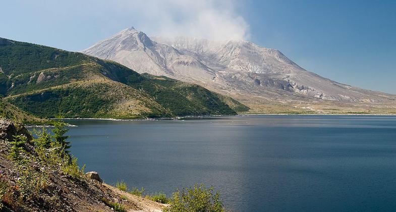
Mt. St. Helens and Spirit Lake. Photo by Greg Willis wiki.

Spirit Lake Trail. Photo by Greg Willis wiki.

Spirit Lake Washington. Photo by Steven Pavlov wiki.

Spirit Lake. Photo by Greg Willis wiki.
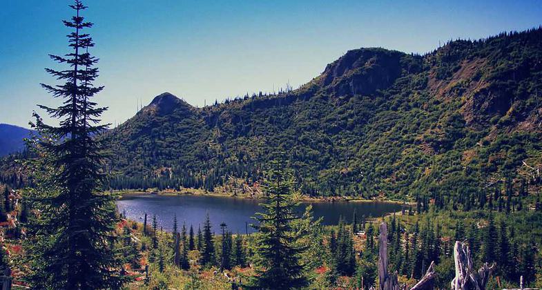
Meta Lake. Photo by Steven Pavlov wiki.
Location: In Mt. St. Helens Volcanic National Mon., just S of Spirit Lake on FS Rd. 99.
- States: Washington
- Counties: Skamania
Easy stroll along paved path with barrier free access into blast zone. Discover the life in the lake and surviving around the volcano.
Accessibility Information
No text provided.
Allowed Uses:
Hiking/WalkingPublic Contact
Jim NielandGifford Pinchot National Forest
Mount St. Helens NUM
Amboy, WA 98601
(360) 247-3946
Contact the trail manager for current maps and visiting details.
More Details
- Elevation (low): --
- Elevation (high): --
- Elevation (cumulative): --
- Part of a Trail System? No
- Surface (primary): --
- Surfaces (additional): --
- Tread Width (average): 42"
- Tread Width (minimum): --
- Running length (minimum): --
- Tread Grade (average, percent): --
- Tread Grade (maximum):
- Running length (maximum): --
- Cross-slope (average, percent): --
- Cross-slope (maximum): --
- Running length (maximum): --
- Certified as an NRT
May 19, 1986