Metacomet-Monadnock Trail
check with the trail manager for updated details before visiting.
Metacomet-Monadnock Trail
State
Backcountry Trail
Frontcountry Trail
- Length
52.2 miles
- Elevation Gain
--
- Route Type
out & back
(1 review)
- Length
52.2 miles - Elevation Gain
-- - Route Type
out & back
The trail has been primarily a backcountry footpath for over 150 years. Two sections of the 117-trail are designated NRTs.
Northern part of Tom Range. Photo by Janie Walker.

Scenery along the Metacomet-Monadnock Trail. Photo by Sarah Bierden.

Scenery along the Metacomet-Monadnock Trail. Photo by Sarah Bierden.

M-M Trail Sign. Photo by Sarah Bierden.

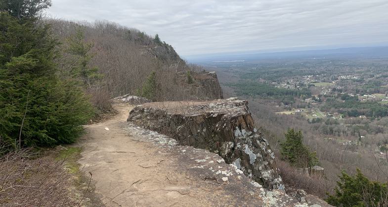
Scenery along the Metacomet-Monadnock Trail. Photo by Sarah Bierden.

Scenery along the Metacomet-Monadnock Trail. Photo by Sarah Bierden.

Scenery along the Metacomet-Monadnock Trail. Photo by Sarah Bierden.

Location: Section 1: Hampden and Hampshire Counties; towns of Holyoke, Easthampton, Hadley, South Hadley, Amherst and Granby, MA . Section 2: Franklin County; towns of Wendell, Erving, Warwick. Royalston, in Worc
- States: Massachusetts
- Counties: Hampshire, Franklin
The trail has been primarily a backcountry footpath for over 150 years. Two sections of the 117 trail are designated NRTs.
The first section is approximately 23 miles and runs along the Mt. Holyoke Range and through Hampden and Hampshire counties. Due to unique geologic formations, this segment takes visitors through a forest environment not usually found in central New England. Its natural and cultural resources include the legendary "Horse Caves," a hiding place used during Shay's Rebellion.
The second section runs approximately 30 miles and crosses Franklin and Worcester counties. This segment allows for natural and human history interpretation in wild and remote terrain. Some trail segments in Section 2 permit snowmobiles, mountain bikes, and equestrian users. Volunteers affiliated with the Berkshire Chapter of the Appalachian Mountain Club maintain the trail. Detailed route descriptions of the trail are at www.amcberkshire.org/mmtrail
Accessibility Information
No text provided.
Reviews
Janie Walker
Lovely part of the New England Trail
I recently hiked the New England National Scenic Trail. The M&M Trail, including the two sections that are considered a National Recreation Trail, are part of this trail. Those two sections of the M&M (and the rest of it, for that matter) are beautiful and well maintained. Favorite parts include the northern section of the Tom Range and the Seven Sisters part of the Holyoke Range. Lovely hiking.
Allowed Uses:
Bicycling Equestrian Hiking/Walking Motorized vehicles, snowmobiling Snow, cross-country skiing Snow, snowshoeingOther Activities
- Camping
- Fishing
- Snow, snow play general
- Wildlife viewing / observation
Public Contact
Jennifer HowardMass. Dept. of Environmental Management
136 Damon Rd.
Northampton, MA 1060
[email protected] • (443) 586-8706 ext. 18
Contact the trail manager for current maps and visiting details.
More Details
- Elevation (low): --
- Elevation (high): --
- Elevation (cumulative): --
- Part of a Trail System? No
- National Designations: None/unknown
- Surface (primary): Soil
- Surfaces (additional): Soil
- Tread Width (average): 48"
- Tread Width (minimum): --
- Running length (minimum): --
- Tread Grade (average, percent): --
- Tread Grade (maximum):
- Running length (maximum): --
- Cross-slope (average, percent): --
- Cross-slope (maximum): --
- Running length (maximum): --
- Certified as an NRT
May 31, 2001