Middle Fork Applegate
check with the trail manager for updated details before visiting.
Middle Fork Applegate
USDA Forest Service
Backcountry Trail
- Length
5.7 miles
- Elevation Gain
--
- Route Type
out & back
- Length
5.7 miles - Elevation Gain
-- - Route Type
out & back
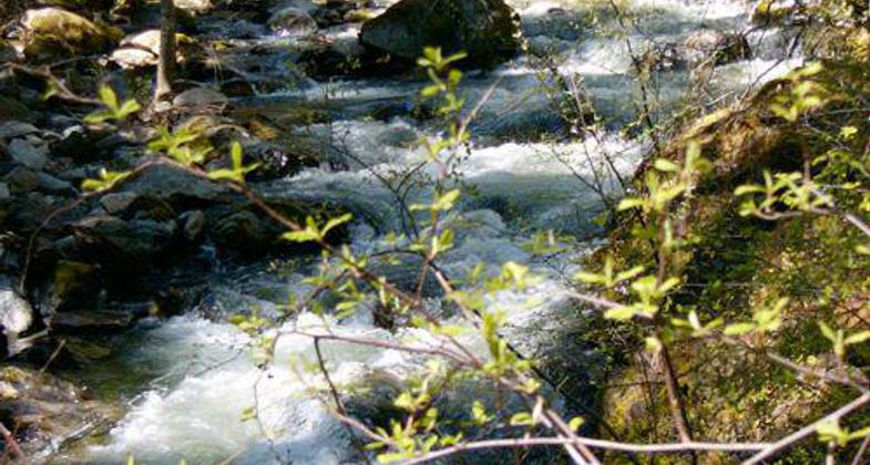
The Middle Fork National Recreation Trail is a beautiful hike or horseback ride that follows the Middle Fork of the Applegate River.
Location: Backcountry and wilderness on the Rogue River-Siskiyou National Forest southwest of Applegate Lake. Accessed from Whiskey Creek Road at Sweaty Gulch Trail.
- States: California
- Counties: Siskiyou
This trail offers opportunities for swimming in the emerald pools of the river, fishing for brook trout, or picnicking along the river's edge. While several springs are found along the trail, the water sources have not been tested and may be unsafe to drink. Water treatment is recommended. This is a good hike to view brilliant autumn colors!
The upper section of this trail is not recommended for horse use due to the narrow tread and rocky creek crossings. The trailhead on the 1035 road provides the best access for a horseback rider with reasonable turnaround room for vehicles with trailers.
Beginning on Forest Service Road 1035, the trail passes through lush fern grottos, unique pothole formations, and deep swimming holes. The forest displays a mixed deciduous stand of alder, dogwood, and big-leaf maple. After 3.4 miles the trail crosses Forest Service Road 1040 at the Frog Pond/Cameron Meadows Trailhead.
The upper section of the trail is within the Red Buttes Wilderness for approximately 0.5 miles. The forest changes dramatically to mixed stands of old-growth Douglas-fir, white fir, incense cedar, and ponderosa pine. Huckleberry, hazelnut, and vine maple form a dense understory. The trail ends on Forest Service Road 1040-600 at Bean Gulch.
Accessibility Information
No text provided.
Allowed Uses:
Bicycling Swimming Dogs, off leash EquestrianOther Activities
- Camping
- Fishing
Public Contact
Steve JohnsonRogue River-Siskiyou National Forest
Applegate Ranger District
Jacksonville, OR 97530
[email protected] • (541) 899-3800
www.fs.usda.gov/rogue-siskiyou
Contact the trail manager for current maps and visiting details.
More Details
- Elevation (low): 2860
- Elevation (high): 4200
- Elevation (cumulative): --
- Part of a Trail System? No
- Surface (primary): Soil
- Surfaces (additional): --
- Tread Width (average): 18"
- Tread Width (minimum): --
- Running length (minimum): --
- Tread Grade (average, percent): --
- Tread Grade (maximum):
- Running length (maximum): --
- Cross-slope (average, percent): --
- Cross-slope (maximum): --
- Running length (maximum): --
- Certified as an NRT
May 17, 1981


