Missouri National Recreational River Water Trail
check with the trail manager for updated details before visiting.

Missouri National Recreational River Water Trail
Nonprofit
National Water Trail
- Length
147 miles
- Elevation Gain
--
- Route Type
out & back
- Length
147 miles - Elevation Gain
-- - Route Type
out & back
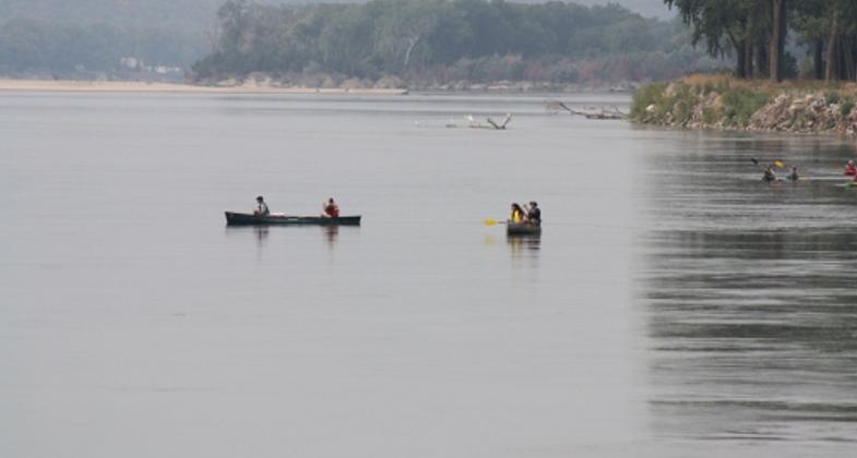
The Missouri National Recreational River Water Trail contains some of the last remaining natural stretches of America's longest river. Come canoe, kayak, and camp along the trail as you experience the Missouri River as Lewis and Clark saw over two hundred years ago. The astonishing array of wildlife, scenic vistas and national significant history make a trip down this stretch of river a once in a lifetime experience.
Location: The Missouri National Recreational River (MNRR) Water Trail begins at Fort Randall Dam near Pickstown, SD and extends 147 miles to Sioux City, Iowa.
- States: Iowa, Nebraska, South Dakota
- Counties: Bon Homme, Charles Mix, Clay, Gregory, Union, Yankton, Cedar, Dakota, Dixon, Knox
- Cities/Townships: Pickstown, SD; Niobrara, NE; Santee, NE; Running Water, SD; Springfield, SD; Yankton, SD; St. Helena, NE; Vermillion, SD
The Missouri National Recreational River Water Trail contains some of the last remaining natural stretches of America's longest river. Come canoe, kayak, and camp along the trail as you experience the Missouri River as Lewis and Clark saw over two hundred years ago. The astonishing array of wildlife, scenic vistas, and national significant history make a trip down this stretch of river a once-in-a-lifetime experience.
Two sections of the Missouri River are included in the Wild and Scenic Rivers Act to preserve and protect the relatively free-flowing condition and natural and cultural landscapes. The Missouri National Recreational River Water Trail contains some of the last remaining natural stretches of North America's longest river. Visitors can canoe, kayak, and camp along the entire stretch of the water trail. Learn about local Native Americans, and settlers, and how the steamboat transported people and goods for decades on the river's dangerous waters. Users of the trail float along the same path that Lewis and Clark explored over two hundred years ago. Visitors can actually witness several locations recorded by Lewis and Clark in their journals.
The water trail is also a great place to view wildlife. The area contains many bald eagles as well as three endangered species including the Piping Plover, Least Tern, and Pallid Sturgeon. The trail contains much natural and scenic beauty. Witness gently sloping to steep dissected bluffs and chalky limestone formations. As visitors paddle down the trail they can view old-growth cottonwood forests on sandbars and along the riverbank. Several federal, state, and local agencies and organizations promote and maintain the Missouri National Recreational River Water Trail for visitors who want to experience one of America's most historic rivers.
Accessibility Information
No text provided.
Allowed Uses:
Boating, motorized Boating, human-powered SwimmingOther Activities
- Camping
- Fishing
- Heritage and history
- Wildlife viewing / observation
Public Contact
Tom DownsNational Park Service
508 East 2nd Street
Yankton, SD 57078
[email protected] • (605) 665-0209
More Details
- Elevation (low): --
- Elevation (high): --
- Elevation (cumulative): --
- Part of a Trail System? No
- National Designations: National Recreational River (Administered by NPS)
- Surface (primary): --
- Surfaces (additional): --
- Tread Width (average): 0"
- Tread Width (minimum): 0
- Running length (minimum): --
- Tread Grade (average, percent): --
- Tread Grade (maximum):
- Running length (maximum): --
- Cross-slope (average, percent): 0
- Cross-slope (maximum): --
- Running length (maximum): --
- Certified as an NRT
Sep 30, 2013


