Mohave Water Trail
check with the trail manager for updated details before visiting.

Mohave Water Trail
National Park Service
National Water Trail
- Length
76 miles
- Elevation Gain
--
- Route Type
Loop
- Length
76 miles - Elevation Gain
-- - Route Type
Loop
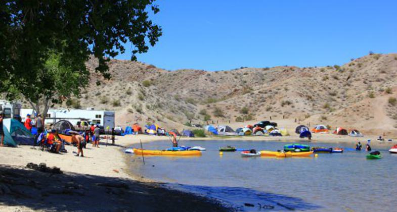
The 76-mile-long Mohave Water Trail stretches along the Arizona and Nevada shorelines of Lake Mohave and the Colorado River below Davis Dam to Laughlin/Bullhead City. It provides access to sandy beaches, scenic desert areas, and unique historic sites, including submerged cultural resources. Boat rentals, shuttle and guide service for paddle craft, scuba diving, fishing, camping, and overnight accommodations and restaurants are available at two marinas and in Laughlin and Bullhead City.

NV Telephone Cove. Photo by Black Canyon and Mohave Water Trails Alliance

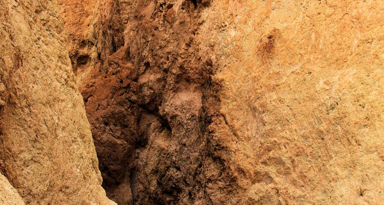
Palo Verde Canyon

Lower Grapevine Canyon

Eldorado Canyon

Cabin Site Point

Az Telephone Cove
Location: The trail straddles the boundary of Arizona and Nevada from Eldorado Canyon on Lake Mohave to the Laughlin/Bullhead City Bridge, a distance of 37 miles along each shoreline of Lake Mohave and 2 miles of the Colorado River below Davis Dam for a total dista
- States: Arizona, Nevada
- Counties: Clark, Mohave
- Cities/Townships: Laughlin, Bullhead City
The 76-mile-long Mohave Water Trail on the Colorado River between Arizona and Nevada is located in one of the fastest-growing regions of the United States and is within a day's drive of large metropolitan areas in southern California, Utah, and Arizona. It lies adjacent to Las Vegas, Nevada, which receives more than 43 million visitors annually. The recreation opportunities are open year around and have room to provide enhanced recreation opportunities to the public. In 2015, the area covered by the Mohave Water Trail received over 2 million visitors. A second National Water Trail at Lake Mead National Recreation Area (the first is the 30-mile-long Black Canyon Water Trail) would extend the ecotourism opportunities of the area. The National Park Service and the Bureau of Reclamation, which operates and manages the dams on the Colorado River, also consider the establishment of water trails as an excellent vehicle to enhance the educational experience of users, and for generating greater public awareness of the importance and multiple uses of the West's water resources. In fact, a successful partnership (Lower Colorado River Water Trail Alliance) of agencies and private individuals and businesses have joined together to provide guidance and assist in planning and developing information to further enhance the visitor experience on both the Black Canyon Water Trail and the Mohave Water Trail.
The Mohave Water Trail lies within the National Park Service's Lake Mead National Recreation Area, the premier inland water recreation area in the West. The Trail's setting in the Mojave Desert features unique natural features, including distinctive geology and key plant and animal species adapted to the exclusive desert setting.
Lake Mohave, named for the Mohave Indians who previously inhabited this region, lies between the Black Mountains to the east in northwestern Arizona, and the Eldorado and Newberry Mountains to the west in southern Nevada. The northern section of the reservoir is constrained by the steep rock walls of Black Canyon for a length of 22 miles and is narrower than 300 feet in places. This portion of the reservoir is primarily riverine and is where the Black Canyon Water Trail is located. South of Black Canyon, Lake Mohave gradually widens to nearly four miles in Cottonwood Basin. The transition between river and true reservoir conditions occurs in Eldorado Canyon, where the Mohave Water Trail starts. Lake Mohave has around 250 miles of shoreline and over 200 coves, most located along the Mohave Water Trail route. The Lake is known for its water quality, consistent lake elevation levels, warm water, sandy beaches, and year-round recreation opportunities.
What makes the Mohave Water Trail so fascinating and significant is the opportunity it offers for exploration. Along the trail, there are some 90 miles of shoreline and over 100 coves on the Nevada side and some 85 miles of shoreline and over 80 coves on the Arizona side. These offer protected areas from the wind and good camping spots. What distinguishes Lake Mohave from Lake Mead is the number of sandy beaches and limited water elevation changes. Camping is allowed everywhere on Lake Mohave and is a very popular activity, as is boating, paddling, swimming, skiing, and fishing. There is a fascinating history of the area associated with the early days of the Colorado River. For example, the Eldorado Canyon area is known for its mining history which was active when Nevada achieved statehood in 1864. The Techatticup Mine is actively interpreted just outside the Park boundary near the community of Nelson. Tours of the Techatticup Mine are offered daily. Although inundated by the waters of Lake Mohave, the docks and loading bins associated with this mine's activities are still present and monitored by the National Park Service.
Below Davis Dam, the Water Trail runs adjacent to several miles of the Colorado River Heritage Greenway Park and Trails, and the planned route of the Arizona Heritage Trail. These trail systems which can be accessed via the portage around Davis Dam or the take-out point near Laughlin feature riverside trails for walkers, bicyclists, and equestrians, accessible fishing sites, and a fully appointed day-use park with Davis Dam as its backdrop. The Mohave Water Trail joined with these projects, connects community members and visitors alike with opportunities for eco-tourism and outdoor adventure, and chances to enjoy unique vistas and historic sites related to the construction of Davis Dam.
Accessibility Information
No text provided.
Allowed Uses:
Boating, motorized Boating, human-powered SwimmingOther Activities
- Camping
- Fishing
- Heritage and history
- Wildlife viewing / observation
Public Contact
Bill MartinBureau of Reclamation
Lower Colorado Region
Boulder City, NV 89006
[email protected] • (702) 293-8375
More Details
- Elevation (low): --
- Elevation (high): --
- Elevation (cumulative): --
- Part of a Trail System? No
- National Designations: NPS and Reclamation Mohave Water Trail
- State Designations: NV and AZ (in progress) Mohave Water Trail
- Surface (primary): --
- Surfaces (additional): Rock, boulders, Rock, smooth, Water, calm
- Tread Width (average): 0"
- Tread Width (minimum): 0
- Running length (minimum): --
- Tread Grade (average, percent): --
- Tread Grade (maximum):
- Running length (maximum): --
- Cross-slope (average, percent): 0
- Cross-slope (maximum): --
- Running length (maximum): --
- Certified as an NRT
Oct 25, 2020


