Montlake Cut National Waterside Trail
This information is a public record of the 1971 NRT application and may be out of date if it has not been updated by a trail manager --
check with the trail manager for updated details before visiting.
check with the trail manager for updated details before visiting.
Montlake Cut National Waterside Trail
U.S. Corps of Engineers
Urban Trail
- Length
0.3 miles
- Elevation Gain
--
- Route Type
out & back
- Length
0.3 miles - Elevation Gain
-- - Route Type
out & back
Location: In Seattle on Hwy. 520 W take Montlake Blvd. exit, then first R on Hamlin, E to East Shelby.
- States: Washington
- Counties: King
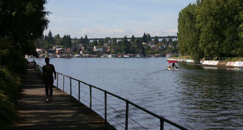
Trail parallels historic Montlake cut. Across the Ship Canal is the University of Washington campus. Excellent vessel viewing.
Accessibility Information
No text provided.
Allowed Uses:
Bicycling Dogs, on leash Hiking/WalkingPublic Contact
Dru ButterfieldUS Army Corps of Engineers
3015 NW 54th St.
Seattle, WA 98107
[email protected] • (206) 789-2622 ext. 2
Contact the trail manager for current maps and visiting details.
More Details
- Elevation (low): --
- Elevation (high): --
- Elevation (cumulative): --
- Part of a Trail System? No
- Surface (primary): --
- Surfaces (additional): --
- Tread Width (average): 70"
- Tread Width (minimum): --
- Running length (minimum): --
- Tread Grade (average, percent): --
- Tread Grade (maximum):
- Running length (maximum): --
- Cross-slope (average, percent): --
- Cross-slope (maximum): --
- Running length (maximum): --
- Certified as an NRT
Jun 1, 1971


