Mount Timpanogos Trail
This information is a public record of the 1979 NRT application and may be out of date if it has not been updated by a trail manager --
check with the trail manager for updated details before visiting.
check with the trail manager for updated details before visiting.
Mount Timpanogos Trail
USDA Forest Service
Backcountry Trail
- Length
18 miles
- Elevation Gain
--
- Route Type
out & back
- Length
18 miles - Elevation Gain
-- - Route Type
out & back
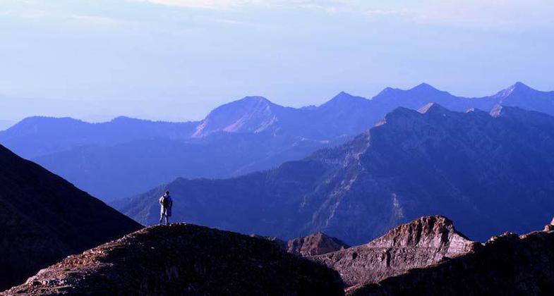
Mount Timpanogos National Recreation Trail, near American Fork, Utah; photo by Eddie Gerritsen.

Winner 2024 NRT Photo Contest, Environmental Features, Flora, and Fauna

The descent down from the saddle, heading south on the trail. Photo by Eddie Gerritsen.

Part of the ridge line. Photo by Eddie Gerritsen.

The many different shades of blue outlines other canyons and mountains. Photo by Eddie Gerritsen.

Small flowers along trail. Photo by Eddie Gerritsen.

Mountain Goat kid. Photo by Eddie Gerritsen.

Wildlife on a Timpanogos trail. Photo by Eddie Gerritsen.
Location: In the Uinta NF, 20 mi. NE of Provo.
- States: Utah
- Counties: Utah
The Mount Timpanogos trail works its way up the spectacular Primrose Cirque to the Emerald Lake basin. The trail then junctions with the Timpooneke trail #053, and the Timpanogos Summit trail #054. Several waterfalls can be seen from the trail.
Accessibility Information
No text provided.
Allowed Uses:
Hiking/WalkingPublic Contact
Uinta National Forest88 West 100 North
Provo, UT 84601
Contact the trail manager for current maps and visiting details.
More Details
- Elevation (low): --
- Elevation (high): --
- Elevation (cumulative): --
- Part of a Trail System? No
- Surface (primary): --
- Surfaces (additional): --
- Tread Width (average): 0"
- Tread Width (minimum): --
- Running length (minimum): --
- Tread Grade (average, percent): 10
- Tread Grade (maximum): 30
- Running length (maximum): --
- Cross-slope (average, percent): --
- Cross-slope (maximum): --
- Running length (maximum): --
- Certified as an NRT
Oct 4, 1979