Mountains to Sea Trail
check with the trail manager for updated details before visiting.
Mountains to Sea Trail
Nonprofit
Frontcountry Trail
Urban Trail
- Length
22 miles
- Elevation Gain
--
- Route Type
out & back
- Length
22 miles - Elevation Gain
-- - Route Type
out & back
This 22-mile trail passes through portions of five towns and cities and unincorporated areas of Orange County.
Location: Irvine Ranch, Orange County, Connects Irvine Ranch S through Irvine to Newport Beach.
- States: California
- Counties: Orange
This 22-mile trail passes through portions of five towns and cities and unincorporated areas of Orange County.
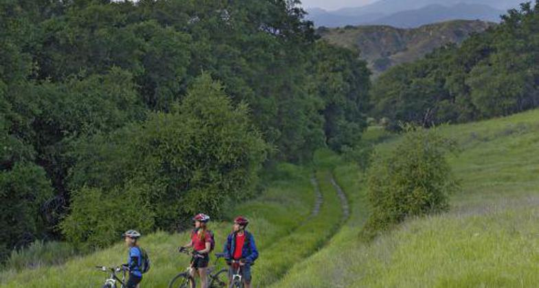
Your journey begins with a docent-led hike in the rugged, oak-filled Weir Canyon. It then takes you south through six jurisdictions, five cities, and a portion of the County of Orange - guaranteeing that the only constant on this trek is an exhilarating change of scenery and topography.
The Mountains to Sea Trail, the backbone of the 50,000-acre Irvine Ranch Natural Landmarks, was created through cooperative municipal planning to let people of all ages and abilities experience unimpeded the magnitude, magnificence, and diversity of the Reserve.
From Weir Canyon to Irvine and Peters Canyon Regional Parks, past the historical Irvine Ranch agricultural headquarters, and along the San Diego Creek Channel to Upper Newport Bay, there's no more enjoyable way to experience one of the nation's most spectacular networks of parks, trails, and preserved natural lands.
Accessibility Information
No text provided.
Allowed Uses:
Bicycling Swimming Dogs, on leash Equestrian Hiking/WalkingOther Activities
- Wildlife viewing / observation
Public Contact
Wida KarimIrvine Ranch Conservancy
4727 Portola Parkway
Irvine, CA 92620
[email protected] • (714) 508-4760
www.irconservancy.org
Contact the trail manager for current maps and visiting details.
More Details
- Elevation (low): --
- Elevation (high): 1339
- Elevation (cumulative): --
- Part of a Trail System? No
- Surface (primary): Paved
- Surfaces (additional): Rock, crushed, Soil
- Tread Width (average): 120"
- Tread Width (minimum): --
- Running length (minimum): --
- Tread Grade (average, percent): --
- Tread Grade (maximum):
- Running length (maximum): --
- Cross-slope (average, percent): --
- Cross-slope (maximum): --
- Running length (maximum): --
- Certified as an NRT
May 31, 2006


