Mt. Edgecombe
check with the trail manager for updated details before visiting.
Mt. Edgecombe
USDA Forest Service
Backcountry Trail
- Length
7 miles
- Elevation Gain
--
- Route Type
out & back
- Length
7 miles - Elevation Gain
-- - Route Type
out & back
The Mt. Edgecumbe Trail located on the southeastern coast of Kruzof Island about 10 miles west of Sitka or a 30 minute boat ride from Sitka to trailhead just south of the Fred's Creek Cabin.
Location: Near Sitka on Kruzof Island. Starts at Fred's Creek Cabin.
- States: Alaska
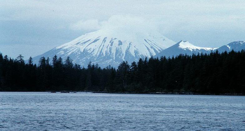
The Mt. Edgecumbe Trail leads seven miles from a remote ocean beach to the summit of Mt. Edgecumbe, a Mt. Fuji-like volcano that is the scenic centerpiece of Sitka, Alaska.
The trail is located on Kruzof Island about ten miles west of Sitka and is accessible by a half-hour boat ride from the Sitka city docks. At the trailhead, a mooring buoy for boat moorage and a new Forest Service recreation cabin was installed in 2003. (The cabin, Fred's Creek Cabin, sleeps eight, and is available for public use through the National Recreation Reservation System). Reconstruction of the entire trail was completed in 2002 using innovative materials and techniques to provide a gravel walking surface that blends seamlessly with the natural environment.
Mt. Edgecumbe Trail begins at Fred's Creek cabin in a Sitka Spruce flat. Heading west, it gradually rises, traversing several miles of muskeg alternating with forest. Four miles up the trail at the crook in a small stream, a three-sided Adirondack shelter built from local timbers is available free of charge for hikers. About a mile past the shelter, the trail steepens considerably as it climbs the mountain's flank. An English trail construction method known as stone pitching was used in this section to create a flagstone surface to rehabilitate the heavily eroded trail section. Timberline is reached at about 2000 feet in elevation. The final steep pitch of the mountain slope to the crater rim is covered by red volcanic ash and low-lying vegetation. Above the tree line, trail cedar post cairns lead the way for hikers who may become disoriented in fog or clouds. On a clear day, the panoramic vista from the summit is spectacular.
Mt. Edgecumbe Trail (and the associated Forest Service recreation cabin) offers a unique hiking (and camping) experience for those looking for an Alaskan adventure. Boating; beachcombing; berry picking; the opportunity to view brown bears, Sitka black-tail deer, and other wildlife; and a great hike from sea level to a 3,000 feet summit make this a stellar destination.
Accessibility Information
No text provided.
Allowed Uses:
Dogs, on leash Hiking/WalkingOther Activities
- Camping
Public Contact
Tongass National ForestSitka Ranger District
Sitka, AK 99835
srtka.rd/[email protected] • (907) 747-6671
Contact the trail manager for current maps and visiting details.
More Details
- Elevation (low): --
- Elevation (high): --
- Elevation (cumulative): --
- Part of a Trail System? No
- Surface (primary): --
- Surfaces (additional): --
- Tread Width (average): 18"
- Tread Width (minimum): --
- Running length (minimum): --
- Tread Grade (average, percent): --
- Tread Grade (maximum):
- Running length (maximum): --
- Cross-slope (average, percent): --
- Cross-slope (maximum): --
- Running length (maximum): --
- Certified as an NRT
Dec 12, 1979


