Mt. Helena Ridge
check with the trail manager for updated details before visiting.
Mt. Helena Ridge
USDA Forest Service
Backcountry Trail
- Length
5.7 miles
- Elevation Gain
--
- Route Type
out & back
- Length
5.7 miles - Elevation Gain
-- - Route Type
out & back
The Mount Helena Ridge Trail is located only a short distance from the city of Helena, Montana and is connected to the Mount Helena City Park. The Mount Helena Ridge Trail is 5.9 miles long. The trail begins at a trailhead near Park City, approximately 5 miles south of Helena.

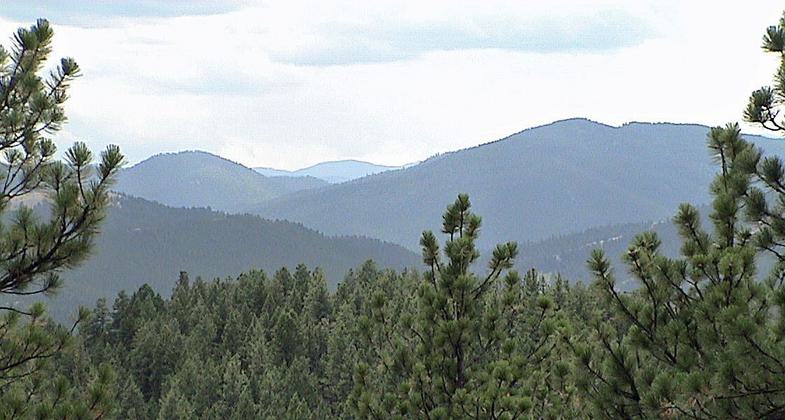
View from Mt. Helena. Photo by RCraig09 wiki.

Devils kitchen Mt. Helena. Photo by RCraig09 wiki.

Mt. Helena Airport from Mt. Helena. Photo by RCraig09 wiki.

Mt. Helena Trail. Photo by RCraig09 wiki.
Location: Rocky Mountains, Trailhead in Helena at west end of Adams St, joins to Grizzly Gulch Road.
- States: Montana
- Counties: Lewis and Clark
The Mount Helena Ridge Trail is located only a short distance from the city of Helena, Montana, and is connected to Mount Helena City Park. The Mount Helena Ridge Trail is 5.9 miles long. The trail begins at a trailhead near Park City, approximately 5 miles south of Helena.
This trail offers a moderate challenge to hikers but offers excellent, continually changing, vistas of the country just east of the Continental Divide. The northern end of the trail ties into the extensive trail system of Mount Helena City Park on the southern edge of Montana's state capital, Helena.
The proximity of the trail allows hikers to literally hike from their hotel rooms in downtown Helena right into the Helena National Forest. With a shuttle to the southern terminus of the trail, the Park City trailhead, a hiker can walk most of the 5.7-mile hike down the ridge line into the City Park. This trail is most popular with hikers and mountain bikers.
Accessibility Information
No text provided.
Allowed Uses:
Bicycling Dogs, on leash Equestrian Hiking/Walking Snow, cross-country skiing Snow, snowshoeingOther Activities
- Camping
- Snow, snow play general
Public Contact
Kurt CuneoHelena National Forest
2001 Popular
Helena, MT 59601
[email protected] • (406) 449-5490
www.fs.fed.us/r1/helena
Contact the trail manager for current maps and visiting details.
More Details
- Elevation (low): 5000
- Elevation (high): 5800
- Elevation (cumulative): --
- Part of a Trail System? No
- Surface (primary): Soil
- Surfaces (additional): Soil
- Tread Width (average): 12"
- Tread Width (minimum): --
- Running length (minimum): --
- Tread Grade (average, percent): 5
- Tread Grade (maximum): 25
- Running length (maximum): --
- Cross-slope (average, percent): --
- Cross-slope (maximum): --
- Running length (maximum): --
- Certified as an NRT
Mar 15, 1979

