Munising Cross Country Ski Trail
This information is a public record of the 1984 NRT application and may be out of date if it has not been updated by a trail manager --
check with the trail manager for updated details before visiting.
check with the trail manager for updated details before visiting.
Munising Cross Country Ski Trail
National Park Service
- Length
11.7 miles
- Elevation Gain
--
- Route Type
out & back
- Length
11.7 miles - Elevation Gain
-- - Route Type
out & back

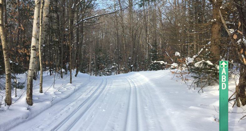
Groomed and ready for a weekend. Photo by NPS.

Cross-country ski trail. Photo by NPS/Shaun Hughes.
Location: At Pictured Rocks NL, 3 miles from Munising on Co. Rd. H 58.
- States: Michigan
- Counties: Alger
Series of interconnected loops, groomed for XC skiing in winter. Winds through beech, maple, hemlock, conifer woods, with spectacular views of Lake Superior's Munising Bay, Grand Island and forest below. Wide range of wildlife and birds.
Accessibility Information
No text provided.
Allowed Uses:
Hiking/Walking Snow, cross-country skiingPublic Contact
Superintendent GrautPictured Rocks National Lakeshore
P.O. Box 40
Munising, MI 49862
[email protected] • (906) 387-2607
www.nps.gov/piro
Contact the trail manager for current maps and visiting details.
More Details
- Elevation (low): --
- Elevation (high): --
- Elevation (cumulative): --
- Part of a Trail System? No
- Surface (primary): --
- Surfaces (additional): --
- Tread Width (average): 96"
- Tread Width (minimum): --
- Running length (minimum): --
- Tread Grade (average, percent): --
- Tread Grade (maximum):
- Running length (maximum): --
- Cross-slope (average, percent): --
- Cross-slope (maximum): --
- Running length (maximum): --
- Certified as an NRT
Mar 29, 1984

