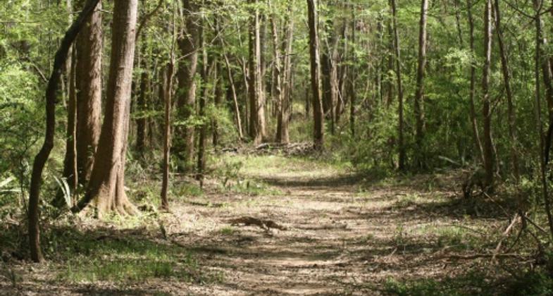
Muscle Shoals
check with the trail manager for updated details before visiting.
Muscle Shoals
Other Federal
Frontcountry Trail
- Length
12 miles
- Elevation Gain
--
- Route Type
out & back
- Length
12 miles - Elevation Gain
-- - Route Type
out & back
Location: Six trails at the Muscle Shoals Reservation at Wilson Dam SE of Florence. (recertified in 1992)
- States: Alabama
- Counties: Colbert
The Tennessee Valley Authority (TVA) Muscle Shoals Trail Complex was designated a National Recreation Trail in 1981. It is located in Colbert County, Alabama along the banks of the Tennessee River on the Tennessee Valley Authority Reservation.
The historical significance of the TVA Reservation has been nationally recognized. The trail provides links to numerous historical sites on the reservation while not infringing upon them. Ten sites on the reservation built by the War Department during the early 1900s remain and are listed in or are potentially eligible for listing in the National Register of Historic Places, including the following:
Wilson Dam, first started in 1918 to provide power to the nitrate plants, was completed in 1925. It is significant in that the dam represents a monumental effort by the War Department spearheaded by an order from President Wilson to tame the power of the Tennessee River. The dam is almost 100 feet high and is nearly one mile in length. Wilson Dam is recognized as a historic site by the National Register of Historic Places and has been designated a National Historic Landmark.
The First Quarters Site, approximately seven acres on the reservation, is the site of the first housing made available to the War Department during the construction of Wilson Dam. In 1919 the site was the Administrative Quarters.
Wilson Steam plant, the largest of its kind when it was constructed in 1918, provided power to the U.S. Nitrate Plant during the war effort. The foundations of the plant are still visible from one of the trails in the Muscle Shoals Trail Complex.
The CCC Pavilion is a recreational facility built by the Civilian Conservation Corps in the 1930s. It consists of a covered, open-walled sandstone structure approximately 100 by 40 feet. This location offers a spectacular view of the valley and river below.
One of the historic aspects of the Reservation most relevant to the trail is the two trails that were built by the CCC in the 1930s: the Rockpile Trail and the Small Wild Area Trail. They both exhibit stone stairs, erosion control in gullies, small footbridges, and benches. The Rockpile Trail runs approximately 3.5 miles along the river while the Small Wild Area Trail is confined to a small draw near the river. Both trails are part of the TVA Muscle Shoals Trail Complex. These trails receive approximately 35,000 user visits per year.
The trails also enhance the City of Sheffield's Rails-to-Trails project on the South side of the River and the City of Florence's River Heritage trails on the North side of the River. The trails serve as a link via the Patton Island Bridge. These combinations of trails make it possible to cross the Tennessee River and travel to and from numerous places in Florence, Muscle Shoals, and Sheffield utilizing only trail systems. It offers a non-motorized alternative mode of transportation for the public.
Accessibility Information
No text provided.
Allowed Uses:
Hiking/WalkingPublic Contact
Derek SouthNatural Resources
Muscle Shoals, AL 35661
[email protected] • (256) 386-3429
www.tva.gov
Contact the trail manager for current maps and visiting details.
More Details
- Elevation (low): --
- Elevation (high): --
- Elevation (cumulative): --
- Part of a Trail System? No
- Surface (primary): Paved
- Surfaces (additional): Paved
- Tread Width (average): 0"
- Tread Width (minimum): --
- Running length (minimum): --
- Tread Grade (average, percent): --
- Tread Grade (maximum):
- Running length (maximum): --
- Cross-slope (average, percent): --
- Cross-slope (maximum): --
- Running length (maximum): --
- Certified as an NRT
Nov 26, 1981


